.jpg")
Geographical Overview of Botswana
Botswana is a landlocked country located in Southern Africa, renowned for its diverse geography and rich natural resources. It shares borders with Namibia to the west and north, Zimbabwe to the northeast, Zambia to the north, and South Africa to the south and southeast. The country features vast savannahs, the expansive Okavango Delta, and the Kalahari Desert, which covers a significant portion of its territory. Its geographical landscape plays a crucial role in shaping its ecology, culture, and economy, making Botswana a fascinating subject on a map of Africa.
Location within Southern Africa
Botswana is a landlocked country located in the southern part of Africa, bordered by Namibia to the west and north, Zimbabwe to the northeast, Zambia to the north, and South Africa to the south and southeast. It lies within the Southern African region, characterized by vast savannas, deserts, and lush wildlife reserves. Geographically, Botswana covers an area of about 581,730 square kilometers, making it one of the larger countries in the region. Its location within Southern Africa positions it as a key part of the region’s ecological and economic landscape, with notable features such as the Kalahari Desert and the Okavango Delta, which are vital for biodiversity and tourism.
Bordering Countries
Botswana is a landlocked country located in the southern part of Africa. It is known for its diverse landscapes, including savannahs, deserts, and wetlands, making it a unique region to explore on the map of Africa. The country covers an area of approximately 581,730 square kilometers and features a rich array of wildlife and natural beauty.
- Namibia to the west and southwest
- Zambia to the north
- Zimbabwe to the northeast
- South Africa to the south and southeast
Topographical Features
Botswana, located in the southern part of Africa, is characterized by a diverse and intriguing geographical landscape. The country is predominantly flat with expansive plains and plateaus that stretch across much of its territory. Its topography features a mixture of low-lying areas, gently undulating plains, and notable highlands, especially in the eastern regions. The Kalahari Desert covers a significant portion of Botswana, giving parts of the country a semi-arid and arid climate. In addition, the eastern border regions are marked by the Eastern Highlands, which include the Tswapong and Matobo Hills, adding to the country’s varied topographical features. The Okavango Delta, one of the world’s largest inland deltas, lies in the northwest and is a vital ecological area, supporting rich biodiversity. Rivers such as the Limpopo and Okavango flow through the country, providing essential water sources and shaping the landscape.
Major Rivers and Lakes
Botswana, located in Southern Africa, features a diverse geographical landscape characterized by vast plains, semi-arid deserts, and prominent water bodies. Its strategic position offers a unique blend of natural features that shape its environment and support various ecosystems, making it a significant area to explore on the map of Botswana.
Major Rivers
- Okavango River: Flows into the Okavango Delta, transforming it into one of the world’s largest inland deltas.
- Chobe River: Forms part of the northern border, supporting one of the richest ecosystems in Africa.
- Kuane River: A tributary contributing to the water system in northeastern Botswana.
- Linyanti River: Connects with the Chobe River and sustains diverse wildlife habitats.
Major Lakes and Water Bodies
- Okavango Delta: A UNESCO World Heritage Site, this inland delta is renowned for its sprawling wetlands and abundance of wildlife.
- Makgadikgadi Pans: One of the largest salt flats in the world, representing a dried-up lake bed with significant paleontological sites.
- Lega Lagoon: Located in the northeast, serving as a vital habitat for aquatic species.
Political Map and Administrative Divisions
The political map of Botswana provides a detailed overview of the country’s administrative divisions, highlighting its various regions and local government structures. Understanding these divisions is essential for grasping the nation’s political geography and governance framework. This map serves as a useful tool for visualizing how Botswana is organized territorially and administratively across its landscape.
Central Districts
Botswana’s political map highlights its various administrative divisions, including central districts that are key to the country’s governance structure. The nation is divided into several districts, each serving as an administrative unit for local governance and development planning. The Central District is one of the largest and most significant regions, hosting the country’s capital, Gaborone, and serving as an economic and administrative hub. This district plays a crucial role in the political landscape of Botswana, facilitating regional coordination and governance throughout the country. The map of Botswana clearly delineates these districts, providing a visual understanding of the administrative boundaries and regional organization within the country.
Major Cities and Towns
Botswana is a landlocked country in Southern Africa with a diverse political map and administrative divisions. It is divided into several districts, each governed by local authorities that facilitate regional administration and development. The country’s political structure features a centralized government with a democratic framework, ensuring representation and governance across its regions. Major cities and towns in Botswana include the capital city of Gaborone, which serves as the political and economic hub. Other significant towns include Francistown, which is a key center for trade and industry, and Maun, known as the gateway to the Okavango Delta. These urban areas are vital for the country’s infrastructure, economy, and cultural identity, contributing to Botswana’s growth and development on the map.
Regional Boundaries
Botswana’s political map showcases its national boundaries and administrative divisions, providing a clear understanding of the country’s territorial organization. The country is divided into several districts, each governed by local authorities that manage regional affairs. These regional boundaries are essential for administrative purposes, land management, and resource distribution. Botswana’s map highlights the relative positions of major cities, towns, and borders with neighboring countries such as Namibia, Zimbabwe, Zambia, and South Africa. Understanding these divisions and boundaries is crucial for navigation, governance, and regional cooperation within Southern Africa.
Natural Landmarks and Protected Areas
Botswana is renowned for its stunning natural landmarks and protected areas that showcase the country’s rich biodiversity and breathtaking landscapes. These regions play a crucial role in conserving wildlife and preserving the natural beauty of Botswana, making it a remarkable destination for eco-tourism and nature enthusiasts. Exploring these protected areas provides a glimpse into the diverse ecosystems that thrive within the nation’s borders.
Okavango Delta
The Okavango Delta in Botswana is one of the world’s most remarkable natural landmarks, renowned for its vast and unique inland delta. This UNESCO World Heritage Site is a sprawling wetland that stretches across the Kalahari Desert, providing vital habitat for diverse flora and fauna. The delta’s intricate network of channels, lagoons, and islands supports a rich ecosystem, making it a crucial protected area for wildlife conservation.
The Okavango Delta is not only a stunning natural wonder but also an important ecological sanctuary. It attracts numerous species, including elephants, lions, hippos, and various waterbirds, offering exceptional opportunities for eco-tourism and research. Efforts to preserve this pristine environment help maintain its ecological integrity, ensuring that future generations can continue to appreciate its natural beauty.
Chobe National Park
Chobe National Park is one of Botswana’s most renowned natural landmarks and a significant protected area, highlighting the country’s rich biodiversity and scenic landscapes. Located in the northern part of Botswana, the park is famous for its vast savannahs, dense forests, and the Chobe River, which supports a diverse array of wildlife. As a key component of Botswana’s conservation efforts, Chobe offers visitors a unique opportunity to observe elephants, lions, buffalo, and numerous bird species in their natural habitat.
- Chobe National Park is home to one of the largest concentrations of elephants in Africa.
- The park covers approximately 11,700 square kilometers, making it a major protected area in Botswana.
- Its landscape includes floodplains, woodlands, and riverine forests, offering varied ecosystems.
- The Chobe River forms part of the country’s border with Namibia, adding to the park’s geographical significance.
- Chobe is part of the Kavango-Zambezi Transfrontier Conservation Area, promoting cross-border conservation efforts.
Makgadikgadi Salt Pans
Makgadikgadi Salt Pans are some of the most remarkable natural landmarks in Botswana, covering an expansive area of former lake beds that once held Lake Makgadikgadi. These salt pans are among the largest in the world, offering a surreal landscape characterized by shimmering salt flats and sparse vegetation. The salt pans serve as a vital habitat for a variety of wildlife, including migrating zebras, wildebeests, and flamingos, especially during seasonal rains when water temporarily floods the pans. This area is protected as part of the Makgadikgadi Pans National Park, ensuring the preservation of its unique ecosystem and providing opportunities for eco-tourism and wildlife viewing. The pans hold cultural significance and showcase Botswana’s diverse natural heritage, making them a key natural landmark on the map of Botswana’s protected areas.
Tsodilo Hills
Tsodilo Hills, located in Botswana, is a renowned natural landmark and a UNESCO World Heritage Site. These hills are famous for their impressive rock formations and are often referred to as the “Louvre of the Desert” due to the numerous ancient rock paintings found there. Protected areas like Tsodilo Hills play a crucial role in preserving Botswana’s rich cultural heritage and diverse ecosystems. Visitors to Botswana can explore these unique natural features and learn about the area’s historical significance while enjoying the stunning landscape and wildlife preserved within the boundaries of the protected zone.
Economic Zones and Land Use
Economic zones and land use play a crucial role in shaping Botswana’s development and spatial organization. These zones are designated areas optimized for industrial, commercial, and technological growth, fostering economic diversification and investment. Proper land use planning ensures sustainable development, balancing urban expansion with conservation efforts. Understanding the distribution and management of these zones provides insight into Botswana’s economic strategy and land utilization on the map of the country.
Agricultural Regions
In Botswana, the strategic designation of Economic Zones and land use planning are essential to fostering sustainable development and optimizing land management across different regions, including agricultural areas. These zones are established to promote industrial growth, attract investments, and enhance agricultural productivity, while land use policies ensure balanced development and conservation.
- Economic Zones in Botswana are often located near major urban centers and transportation hubs to facilitate trade and industrial activities.
- Agricultural regions primarily occupy the eastern and southern parts of the country, where the land is suitable for crop cultivation and livestock farming.
- Land use planning in Botswana emphasizes the preservation of protected areas and wildlife corridors while allowing for agricultural expansion in designated zones.
- Special economic zones include areas for agro-processing industries, which aim to add value to raw agricultural products.
- The government promotes sustainable land use practices to prevent overexploitation and ensure long-term productivity of agricultural lands.
- On the map of Botswana, these zones and regions are distinguished by different color codes, indicating their specific functions and land use designations.
Mining Areas
In Botswana, designated Economic Zones play a vital role in promoting industrial development and attracting investment, with specific attention to land use planning to ensure sustainable growth. These zones often include specialized mining areas where mineral extraction is a key economic activity, such as diamonds and other valuable resources. Land use within these zones is carefully managed to balance environmental concerns, community development, and economic benefits. Mining areas are typically located in regions with rich mineral deposits, and their development involves strict regulations to maximize resource extraction while minimizing environmental impact. Overall, the strategic planning of economic zones and land use in mining areas is essential for Botswana’s economic progression and environmental conservation.
Urban and Industrial Centers
Economic zones and land use patterns are crucial aspects of Botswana’s development strategy, reflecting the nation’s focus on balancing urban growth and industrial expansion. Urban centers such as Gaborone, Francistown, and Maun serve as key hubs for commercial activity, administrative functions, and residential life, supporting the country’s economic activities. Industrial centers are strategically positioned to facilitate manufacturing, mining, and other primary industries, often concentrated in specific zones to optimize land use efficiency. These areas are carefully planned to promote sustainable development, prevent urban sprawl, and ensure that infrastructure supports economic growth. The map of Botswana highlights these designated zones, illustrating how land use is organized to foster economic development while maintaining environmental and social stability.
Transportation and Infrastructure on Map
Transportation and infrastructure play a vital role in shaping Botswana’s development and connectivity. The map of Botswana highlights key roads, railways, airports, and ports that facilitate movement within the country and beyond its borders. Efficient transport networks are essential for economic growth, trade, and the well-being of its citizens, making it a crucial aspect of Botswana’s infrastructure planning and development.
Major Roads and Highways
Botswana’s transportation and infrastructure network is well-developed, with a focus on major roads and highways that facilitate movement across the country. These routes connect key cities, towns, and border crossings, ensuring efficient trade and travel. The map highlights important arterial roads that link the capital city Gaborone to other regions, supporting both commercial and local transportation needs. Additionally, key highways such as the Trans-Kalahari Highway enhance regional connectivity with neighboring countries, fostering economic integration and development. Overall, Botswana’s extensive road network plays a crucial role in supporting its growing economy and accessibility.
Railway Network
Botswana’s transportation and infrastructure are well-developed, with a prominent railway network connecting key cities and facilitating the movement of goods and people across the country. The railway system mainly consists of the main lines that extend from the capital, Gaborone, towards major hubs such as Francistown and Sekgna. These railways play a crucial role in supporting the country’s economy, especially in the export of minerals and agricultural products. The map of Botswana highlights these railway routes, making it easier to understand the connectivity within the country and with neighboring nations. Improved infrastructure and ongoing development projects are enhancing transport efficiency, contributing to Botswana’s economic growth and regional integration.
Airports and Airstrips
Bowtwana’s transportation and infrastructure network is well-developed, featuring numerous airports and airstrips that facilitate domestic and international travel. The country’s major airport is Sir Seretse Khama International Airport in Gaborone, which serves as the primary gateway for travelers. Additionally, Botswana has several smaller airports and airstrips scattered across the country, primarily located in remote regions to support connectivity and economic activities. These airstrips are crucial for transportation in less accessible areas, enabling quick access to remote communities and supporting tourism, wildlife management, and government operations. Overall, Botswana’s extensive air transportation infrastructure plays a vital role in maintaining efficient mobility across the nation and enhancing its connectivity on the global stage.
Tourist Attractions and Cultural Sites
Botswana is a captivating destination known for its rich cultural heritage and stunning tourist attractions. Visitors can explore a diverse range of sites that showcase the country’s unique history, vibrant traditions, and breathtaking landscapes. From world-renowned national parks to ancient cultural sites, Botswana offers an unforgettable experience for every traveler.

Luxury Resorts and Safari Lodges
Botswana is renowned for its stunning tourist attractions and rich cultural sites that offer travelers a unique glimpse into its vibrant heritage. Visitors can explore iconic landmarks such as the Tsodilo Hills, a UNESCO World Heritage Site known for its ancient rock art, and the Okavango Delta, a breathtaking natural wonder teeming with wildlife. The country also boasts numerous cultural experiences, including traditional village visits and local craft markets that highlight Botswana’s diverse heritage.
For those seeking luxury, Botswana offers a range of high-end resorts and safari lodges that provide unparalleled comfort amidst pristine wilderness. These lodges often feature opulent amenities, expert-guided safaris, and exclusive experiences designed to immerse guests in the natural surroundings. Notable upscale accommodations include the Xigera Safari Lodge and the Belmond Safaris, which deliver authentic safari adventures with a touch of elegance.
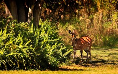
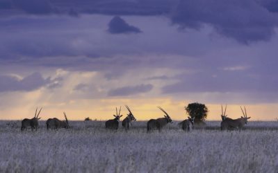
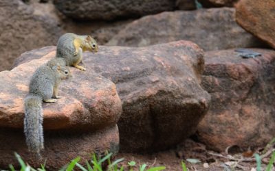
Wildlife enthusiasts can indulge in the unique opportunity to observe Africa’s majestic animals in their natural habitats. The country’s safaris are renowned for their exceptional sightings of elephants, lions, leopards, and numerous bird species, especially in protected areas like Chobe National Park and Moremi Game Reserve. Whether staying in luxury lodges or exploring on guided tours, visitors are assured a memorable and immersive experience that highlights Botswana’s status as a premier safari destination.
Historical and Cultural Heritage Sites
Botswana is a country rich in tourist attractions and cultural heritage, making it a remarkable destination for travelers seeking both natural beauty and historical significance. Visitors can explore diverse wildlife parks, including the world-famous Okavango Delta, a UNESCO World Heritage Site, where they can enjoy safaris and observe unique flora and fauna. The country also boasts vibrant cultural sites such as the Tsodilo Hills, known as the “Louvre of the Desert,” which is home to ancient rock art dating back thousands of years. Additionally, the Makgadikgadi Salt Pans offer a surreal landscape and a glimpse into the country’s prehistoric past. Botswana’s well-preserved historical sites and cultural landmarks provide insight into its rich heritage, making it an essential part of any travel itinerary on the map of Africa. These attractions highlight Botswana’s deep connection to its history and natural environment, welcoming visitors with unforgettable experiences.
Protected Wildlife Species Areas
Botswana is renowned for its diverse tourist attractions and rich cultural sites that offer visitors a glimpse into its vibrant history and traditions. The country boasts vast national parks and game reserves where travelers can experience incredible wildlife safaris and view a variety of protected species in their natural habitat. Among these, the Okavango Delta and Chobe National Park are famous for their abundant wildlife, including elephants, lions, and buffalo. Botswana also preserves numerous cultural heritage sites, such as the Tsodilo Hills, which are UNESCO World Heritage sites known for their ancient rock art.

0 Comments