Geographical Overview of Namibia
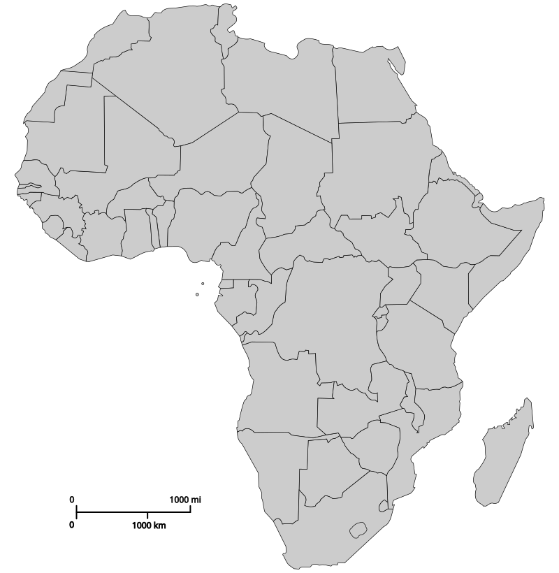
Namibia, a country located in southwestern Africa, boasts a diverse and striking geographical landscape. It is characterized by vast desert regions, including the Namib Desert, which is one of the oldest deserts in the world, as well as rugged mountains, expansive savannas, and fertile river valleys. The country’s strategic position along the Atlantic Ocean provides a picturesque coastline and important marine resources. Namibia’s varied terrain not only defines its natural heritage but also influences its climate, ecosystems, and human activities, making it a key element in understanding its overall map of Africa.
Location within Southern Africa
Namibia is a country located in the southwestern part of Africa, sharing borders with Angola to the north, Zambia to the northeast, Botswana to the east, and South Africa to the south and southeast. It has a coastline along the Atlantic Ocean to the west, which features the world’s oldest desert, the Namib Desert. Situated within Southern Africa, Namibia is characterized by a diverse landscape that includes deserts, savannahs, and mountainous regions. Its strategic location provides access to key regional trade routes and contributes to its rich cultural and geographical diversity.
Bordering Countries: Angola, Zambia, Botswana, South Africa
Namibia is a country located in the southwestern part of Africa, characterized by vast deserts, savannas, and a diverse landscape. It shares borders with four countries: Angola to the north, Zambia to the northeast, Botswana to the east, and South Africa to the south, east, and southwest. These neighboring nations contribute to Namibia’s rich cultural and geographical diversity, influencing its climate, wildlife, and regional interactions. The country is known for features such as the Namib Desert along its Atlantic coast, which is renowned as one of the oldest deserts in the world, and the Kalahari Desert in the east. Namibia’s strategic position within Africa makes it a key region for both ecological conservation and economic activities like mining and tourism. Understanding Namibia’s border connections offers valuable insights into its role within the continent’s geography and regional dynamics.
Major Physical Features
Namibia, located in southwestern Africa, is renowned for its diverse and striking physical features. The country is characterized by vast desert landscapes, including the Namib Desert, known as one of the oldest and most arid deserts in the world, and the Kalahari Desert, which covers much of the eastern part of Namibia. The pavement of the landscape is broken by prominent mountain ranges such as the Brandberg, the highest peak in Namibia, and the Otjihavera Mountains. The country also features extensive coastal plains along the Atlantic Ocean, with the Skeleton Coast famous for its shipwrecks and foggy conditions. Namibia’s interior is marked by high central plateau regions that elevate the terrain and influence the climate, creating a variety of ecological zones. To the southeast, the Okavango River forms part of the fertile delta system that supports rich wildlife and vegetation, making Namibia a country with a remarkable array of major physical features across its map of Africa.
Topographical Features and Landscape
The topographical features and landscape of Namibia are characterized by a diverse and striking array of landforms that shape its unique geography. From vast deserts to rugged mountains, Namibia’s landscape offers a fascinating glimpse into the natural divisions of this southern African country. Understanding these features on the Namibia map of Africa provides insight into the region’s ecological, cultural, and geological significance.
Desert Regions
Namibia, situated in the southwestern part of Africa, features a diverse landscape characterized by striking topographical features. The country is renowned for its expansive desert regions, including the Namib Desert, one of the oldest and most arid deserts in the world. The Namib Desert stretches along the Atlantic coast, featuring towering sand dunes such as Dune 45 and the iconic Sossusvlei area. Inland, Namibia’s landscape transitions to semi-arid savannas and rugged highlands, including the Namibian Plateau, which influences local climate and vegetation. The country’s topography also includes the Fish River Canyon, one of the largest canyons globally, showcasing dramatic escarpments and rugged terrain. These features contribute to Namibia’s unique natural environment, making it a prominent destination for desert scenery, wildlife, and adventure tourism. Understanding Namibia’s landscape on a map of Africa highlights its geographical significance and diverse terrain features.
Major Cities and Urban Areas
Namibia, a captivating country in southwestern Africa, is home to several major cities and vibrant urban areas that serve as key centers of culture, commerce, and administration. These urban regions play a significant role in shaping the nation’s development and offer unique insights into Namibia’s diverse landscape and society. Exploring the map of Africa, particularly Namibia, reveals the strategic locations and importance of its prominent cities in the broader regional context.
Windhoek – Capital and largest city
Windhoek is the capital and largest city of Namibia, situated centrally in the country. As a major urban area, it serves as the political, economic, and cultural hub of Namibia. The city is known for its blend of modern infrastructure and historical German colonial architecture, reflecting Namibia’s diverse heritage. Windhoek is a key point on the Namibia map of Africa, highlighting its significance within the region.
Swakopmund – Coastal resort town
Swakopmund is a prominent coastal resort town located along the Atlantic Ocean in Namibia. Known for its German colonial architecture, sandy beaches, and vibrant outdoor activities, it attracts both tourists and residents alike. Situated roughly 350 kilometers west of Windhoek, the capital of Namibia, Swakopmund serves as a gateway to the Namib Desert and offers a unique blend of coastal and desert landscapes.
Walvis Bay – Major port and fishing industry hub
Walvis Bay is a significant city in Namibia known for its strategic importance as a major port and fishing industry hub. Located along the Atlantic coast, it plays a vital role in Namibia’s economy by facilitating maritime trade and marine resource exploitation. The city’s port infrastructure supports both domestic and international shipping, making it a key gateway for goods entering and leaving the country.
Within the context of a Namibia map of Africa, Walvis Bay stands out as one of the major urban areas that contribute to Namibia’s regional influence and economic development. Its location on the coast offers access to lucrative fishing grounds and enhances Namibia’s maritime connectivity.
- Major port for Namibia, handling significant cargo and fishing activities
- Hubs for maritime commerce and shipping industries
- Center for Namibia’s fishing industry, with extensive fishing fleets and processing facilities
- Strategic coastal location on the Atlantic Ocean
- Contributes to regional trade and economic growth within Namibia and southwestern Africa
Luderitz – Historic goal for diamond mining and exploration
Luderitz is a notable city in Namibia, situated along the southwestern coast of Africa. Historically, it served as a vital hub for diamond mining and exploration, playing a crucial role in Namibia’s economic development. The city’s strategic location and rich mineral resources contributed to its prominence during the early days of diamond discovery in the region.
- Major port for shipping and trade in Namibia
- Historic center for diamond mining and exploration activities
- Gateway for tourists visiting the nearby Kolmanskop Ghost Town and surrounding desert landscapes
- Significant to Namibia’s mining industry and economic growth
Administrative Divisions and Map Details
Administrative divisions and map details are essential for understanding the geographical and political landscape of Namibia within Africa. These divisions help to organize the country into manageable regions, facilitating governance, resource management, and regional development. A detailed map of Namibia provides valuable insights into its territorial boundaries, major cities, rural areas, and natural features, offering a comprehensive overview of the country’s spatial organization.
Key towns within regions
Namibia is a country located in southwestern Africa, characterized by diverse administrative divisions and notable regional towns. The country is divided into several regions, each with its own unique features and key settlements. These divisions help organize governance and facilitate regional development.
- Omusati Region with key town: Outapi
- Omaruru Region with key town: Omaruru
- Omaheke Region with key town: Gobabis
- Khomas Region with key town: Windhoek (capital city)
- Erongo Region with key town: Walvis Bay
- Kavango West Region with key town: Nkurenkuru
- Caprivi Region (now Zambezi Region) with key town: Katima Mulilo
- Kunene Region with key town: Opuwo
- Ohangwena Region with key town: Ongwediva
The map of Namibia within Africa highlights its positioning with major towns serving as administrative and economic hubs, clustered within its 14 regions. These towns are vital centers for transportation, commerce, and cultural activities, forming an essential part of Namibia’s regional identity.
Significant landmarks and protected areas on the map
Namibia’s map of Africa highlights its administrative divisions, which include 14 regions such as Khomas, Erongo, and Otjozondjupa, each serving as a key administrative unit with specific local governance structures.
Map details reveal diverse geographical features, including deserts, mountains, and savannahs, providing a clear view of Namibia’s expansive landscape that spans from the Atlantic coast inland.
Significant landmarks on the map include the Namib Desert, considered one of the oldest deserts in the world, and the Fish River Canyon, which is the second-largest canyon globally and a major natural attraction.
Protected areas are prominently marked, such as Etosha National Park, renowned for its abundant wildlife and salt pan, and the Namib-Naukloft National Park, home to the famous sand dunes and diverse ecosystems.
These features collectively showcase Namibia’s rich natural heritage and the importance of conservation efforts within its geographical and administrative framework.
Natural Resources and Land Use
Natural resources and land use are vital aspects that shape Namibia’s landscape and economy. As a country rich in minerals, wildlife, and diverse ecosystems, Namibia’s approach to utilizing its natural assets plays a crucial role in sustainable development. Understanding its land distribution and resources helps to better comprehend its geographic and economic characteristics within the broader context of Africa.
Mining locations and resource distribution
Namibia, located on the southwestern coast of Africa, is rich in natural resources due to its diverse land features and extensive mineral deposits. The country’s landscape includes deserts, savannas, and coastal regions, which influence the distribution and utilization of its land for various purposes such as agriculture, conservation, and mining. Namibia’s land use policies aim to balance economic development with environmental preservation, especially given its significant areas of protected wildlife and wilderness.
Mining is a vital sector in Namibia, with major mineral resources distributed across different regions. The country is a leading producer of diamonds, mostly mined in the coastal areas near the Namib Desert, and also has substantial deposits of uranium, copper, zinc, and gold found in central and eastern regions. The mineral wealth is concentrated in specific locations, such as the Erongo region for uranium and the Auas Mountains for gold, highlighting the importance of geographic factors in resource distribution.
The resource distribution in Namibia is influenced by geological formations, such as the ancient rock formations and mineral-rich deposits that have formed over millions of years. The strategic location of mining operations along transportation routes facilitates export, especially through ports like Walvis Bay. Namibia’s approach to land and resource management emphasizes sustainable practices to ensure that natural resources contribute to long-term economic stability while protecting the environment.
Agricultural zones and land cultivation areas
Namibia’s map of Africa highlights its diverse natural resources and land use, with a significant focus on agricultural zones and land cultivation areas. The country is rich in minerals such as diamonds, uranium, and copper, which contribute heavily to its economy. Apart from mineral resources, Namibia features expansive arid and semi-arid regions that influence land utilization patterns. Agricultural activities are concentrated mainly in the central regions and along the coastal areas, where farming of livestock and crops such as millet, sorghum, and maize is common. Due to the arid climate, irrigation is essential in many cultivation areas, supporting both subsistence and commercial farming. Conservation efforts also play a vital role in preserving Namibia’s unique ecosystems and promoting sustainable land use practices across different zones of the country.
Conservation areas and national parks
Namibia, located in southern Africa, is renowned for its diverse natural resources and vast land areas. Its landscape includes deserts, savannahs, and mountains, providing a rich habitat for numerous species and supporting various land uses. Conservation efforts are vital in Namibia to protect its unique ecosystems and promote sustainable resource utilization. The country is home to numerous conservation areas and national parks, which play a crucial role in preserving wildlife and promoting eco-tourism.
- Namibia’s natural resources include minerals such as uranium, diamonds, and copper, which are important for the country’s economy.
- The country has established several conservation areas like Etosha National Park, known for its abundant wildlife and safaris.
- Protected areas help conserve biodiversity, support local communities, and attract tourism, contributing to sustainable land use.
- Land use in Namibia balances between conservation, agriculture, and tourism, ensuring environmental preservation while supporting economic activities.
- National parks and game reserves cover a significant portion of Namibia’s land, emphasizing its commitment to conservation and sustainable development.



0 Comments