.jpeg")
Geographical Overview of Morocco
The map of Morocco reveals a diverse and geographically fascinating country located in the northwestern corner of Africa. Characterized by a mix of rugged mountains, expansive deserts, and fertile coastal plains, Morocco’s landscape provides a rich variety of natural features. Its strategic position along the Atlantic Ocean and Mediterranean Sea has influenced its climate, culture, and history, making it a unique destination for exploration and study. Understanding Morocco’s geographical layout offers valuable insights into its regional differences and cultural diversity.
Location and Coordinates
The map of Morocco highlights a country located in the northwestern corner of Africa, offering diverse geographical features that include coastlines, mountains, and desert plains. Morocco is positioned along the Atlantic Ocean to the west and the Mediterranean Sea to the north, providing it with extensive maritime borders. It shares land borders with Algeria to the east and southeast, and Western Sahara to the south. The country’s coordinates are approximately 32° to 36° North latitude and 1° to 14° West longitude, giving it a strategic position that bridges Africa and Europe.
Borders and Neighboring Countries
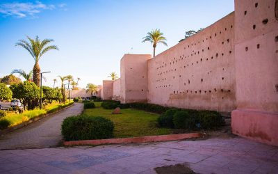
The map of Morocco highlights its diverse geographical features and strategic location in North Africa. Morocco is bordered by the Atlantic Ocean to the west and south, providing it with a lengthy Atlantic coastline, and by the Mediterranean Sea to the north, offering access to European maritime routes. Its neighboring countries include Algeria to the east and southeast, sharing a lengthy land border, and Western Sahara to the south, a region with a complex political status. To the north, Morocco is separated from Spain by the Strait of Gibraltar, a narrow waterway that connects the Atlantic and Mediterranean and marks the boundary between the African continent and Europe. The country’s geographical landscape ranges from the rugged Atlas Mountains and the Sahara Desert in the south to fertile plains and coastal regions, making it a diverse and strategically located nation in the Maghreb region.
Topography and Landscape Features
The map of Morocco showcases a diverse and captivating geographical landscape that ranges from rugged mountain ranges to expansive desert plains. Located in the northwestern corner of Africa, Morocco is bordered by the Atlantic Ocean to the west and the Mediterranean Sea to the north, providing it with extensive coastlines. The country’s topography is characterized by the Atlas Mountains, which run diagonally across the center and south, creating dramatic peaks and deep valleys. The High Atlas peaks, including Jbel Toubkal, the highest point in North Africa, rise prominently within this range. To the southeast, the vast Sahara Desert extends into Morocco, featuring rolling dunes and arid terrain that define the southern landscape. The coastal plains and river valleys, such as the lower Sebou and Souss basins, offer fertile land and are vital for agriculture. The diverse landscape not only influences Morocco’s climate and ecosystems but also contributes to its rich cultural and geographic profile, making the map of Morocco an interesting reflection of natural variety and geographic features.
Major Regions and Divisions
The map of Morocco showcases the country’s diverse geographical landscape, which is divided into several major regions and divisions. These regions reflect Morocco’s rich cultural heritage, varied climate, and administrative organization. Understanding the major regions and divisions provides a clearer picture of the country’s unique characteristics and regional differences.
Rabat-Salé-Kénitra
The Rabat-Salé-Kénitra region is an important administrative division in Morocco, situated along the Atlantic coast in the northern part of the country. It is known for its diverse landscape, which includes urban areas, agricultural land, and coastal zones. The region is divided into several provinces and prefectures, each contributing to its economic and cultural vibrancy.
Casablanca-Settat
The Casablanca-Settat region is one of the major administrative regions in Morocco, situated in the western part of the country along the Atlantic coast. It is a vital economic hub, known for its vibrant cities and diverse landscapes. The region is divided into several prefectures and provinces, including Casablanca, Berrechid, Nouaceur, and Settat, each contributing uniquely to the regional economy and culture.
Casablanca-Settat plays a significant role in Morocco’s development, hosting the country’s largest city, Casablanca, which serves as a financial, commercial, and industrial center. The region also features agricultural zones, urbanized areas, and industrial parks, making it a key area on the map of Morocco. Its strategic location and infrastructure make it an important connector within the country and for international trade.
Marrakech-Safi
The Marrakech-Safi region is one of the major administrative divisions in Morocco, located in the western part of the country. It is known for its diverse landscapes, including mountainous areas, plains, and coastlines along the Atlantic Ocean. The region encompasses several major cities, with Marrakech being the most prominent, famous for its vibrant markets, historical sites, and cultural heritage. Safi, another key city in the region, is renowned for its port and pottery industry. Marrakech-Safi plays an important role in Morocco’s economy, tourism, and cultural identity, making it a significant part of the country’s map.
Fez-Meknes
The Fez-Meknes region is one of the major regions in Morocco, distinguished by its rich history, vibrant culture, and diverse geography. Located in the northern part of the country, it encompasses important cities such as Fez, Meknes, and Taounate. This region is known for its well-preserved medieval architecture, bustling souks, and significant religious and educational institutions like the University of al-Qarawiyyin in Fez.
Fez-Meknes is divided into several administrative divisions or provinces, including Fez, Meknes, Ifrane, El Hajeb, and others. These divisions facilitate local governance, economic development, and cultural preservation. The region’s economy is diverse, with agriculture, crafts, tourism, and manufacturing playing vital roles. Its location also makes it a key gateway connecting northern Morocco to other parts of the country and neighboring regions.
Other Key Regions
The map of Morocco highlights several major regions and divisions that are essential for understanding the country’s geographic and administrative layout. These regions include Casablanca-Settat, Rabat-Salé-Kénitra, Marrakech-Safi, Fez-Meknes, Oriental, Souss-Massa, Tanger-Tetouan-Al Hoceima, and others. Each region is subdivided into smaller governorates and prefectures, reflecting Morocco’s diverse cultural and economic landscape.
In addition to the primary regions, there are other key areas that are significant for tourism, cultural heritage, and natural features. These include the Atlas Mountains, the Sahara Desert, and coastal zones along the Atlantic and Mediterranean seas. These areas contribute greatly to Morocco’s identity and serve as essential points of interest on the map.
Significant Cities and Urban Areas
Significant cities and urban areas play a vital role in the development and cultural identity of Morocco. These cities serve as economic hubs, centers of history, and gateways to understanding the diverse landscape of the country. Exploring the map of Morocco reveals the distribution and importance of these urban areas, highlighting their contributions to national growth and regional connectivity.
Capital City: Rabat
The map of Morocco highlights the country’s diverse geography, with its significant cities and urban areas showcasing the nation’s vibrant culture and development. Among these, the capital city is Rabat, which serves as an important administrative and political center. Rabat is known for its historical sites, diplomatic missions, and modern infrastructure, making it a key urban hub in Morocco. The city is strategically situated along the Atlantic coast, contributing to its importance in trade and government affairs. Other major cities in Morocco include Casablanca, Marrakech, and Fes, each offering unique cultural, economic, and historical significance, collectively illustrating the richness of Morocco’s urban landscape.
Largest City: Casablanca
Casablanca is the largest city in Morocco and a significant urban area on the country’s map. Located along the Atlantic coastline, it serves as a major economic and business hub, contributing substantially to the national economy. The city is known for its modern architecture, busy port, and vibrant cultural scene. As a key point on the map of Morocco, Casablanca exemplifies the rapid urbanization and development seen in Moroccan cities, attracting residents and visitors alike. Its strategic location and diverse infrastructure make it an essential part of the urban landscape of Morocco.
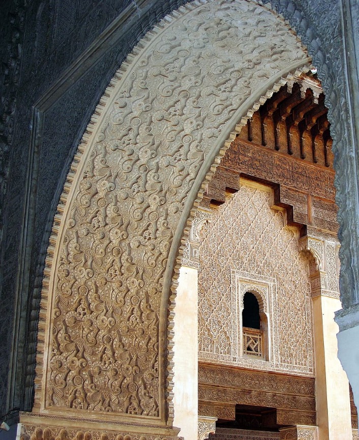
Historic Cities: Marrakech, Fes, Meknes
The map of Morocco highlights several significant cities and historic urban areas that showcase the country’s rich cultural heritage and diverse landscape. Among these, Marrakech, Fes, and Meknes stand out as prominent historic cities with unique attractions and historical significance.
Marrakech, often called the “Red City” due to its terracotta buildings, is renowned for its vibrant souks, historic medinas, and iconic landmarks such as the Koutoubia Mosque and Jemaa el-Fnaa square. It serves as a major cultural and economic hub, blending ancient traditions with modern development.
Fes is famed for its well-preserved medieval medina, a UNESCO World Heritage site, which is considered one of the world’s most authentic historic cities. It houses ancient universities, traditional tanneries, and labyrinthine streets that reflect centuries of Islamic and Moroccan history.
Meknes, another historic city, was once the capital of Morocco under Sultan Moulay Ismail. Its impressive imperial gates, palaces, and mausoleums highlight its significance during the 17th and 18th centuries. The city offers a glimpse into Morocco’s imperial past and is notable for its architectural grandeur.
Natural Features and Landmarks
Morocco is a country renowned for its diverse natural features and iconic landmarks that showcase its rich cultural and geographical heritage. From sweeping deserts and rugged mountains to lush coastlines, the natural landscape plays a vital role in shaping the region’s identity. Exploring the map of Morocco reveals a captivating tapestry of scenic wonders and historical sites that attract travelers from around the world.
Atlas Mountains
The Atlas Mountains are a prominent natural feature of Morocco, stretching across the country from the Atlantic Ocean in the west to the Mediterranean Sea in the north and east. These majestic mountains are part of a larger mountain system that spans several North African countries, but they are particularly significant within Morocco due to their dramatic landscapes and historical importance. The range includes several notable peaks, such as Mount Toubkal, which is the highest in North Africa at 4,167 meters. The Atlas Mountains are characterized by rugged terrains, deep valleys, and lush green forests, making them a vital ecological zone. They also form a natural barrier that influences climate patterns, creating a variation in weather and vegetation across the region. These mountains are home to diverse flora and fauna, as well as many Berber communities that have preserved their unique cultural heritage. The Atlas Mountains are a key feature on the map of Morocco, highlighting the country’s diverse geography and stunning natural landmarks.
Sahara Desert
The Sahara Desert is one of the most prominent natural features in Morocco, covering a significant portion of the southern and eastern parts of the country. This vast expanse of arid wilderness is characterized by towering sand dunes, such as Erg Chebbi and Erg Chigaga, which attract many travelers and explorers. The desert’s landscape also includes rocky plateaus, dry valleys, and sparse vegetation, creating a dramatic and unique environment. The Sahara plays a crucial role in Morocco’s climate, culture, and tourism industry, serving as a symbol of the country’s natural beauty and geographic diversity.
Atlantic and Mediterranean Coasts
The map of Morocco highlights its diverse natural features and iconic landmarks along the Atlantic and Mediterranean coasts. The Atlantic coastline is renowned for its long sandy beaches, vibrant fishing ports, and scenic surf spots, particularly around Essaouira and Agadir. The Mediterranean coast features calm waters and charming coastal towns such as Tangier and Nador, offering a different maritime experience. Inland, Morocco’s landscape includes the towering Atlas Mountains, which create dramatic scenery and are home to numerous hiking trails and stunning vistas. The Rif Mountains in the north contribute to the region’s rugged terrain and agricultural richness. Key natural landmarks include the Sahara Desert in the southeast, known for its expansive dunes and unique desert ecosystems. These features collectively define Morocco’s rich geographical diversity and are essential for understanding its cultural and natural heritage.”
Oases and River Valleys
Morocco is a country rich in natural features and landmarks that highlight its diverse geography. Its landscape includes vast deserts, lush river valleys, and iconic oases, making it a unique destination for travelers and explorers alike.
Oases are scattered throughout the Sahara Desert and serve as vital points of life and activity for local inhabitants. Some notable oases include the Tafilalt Oasis, which is famed for its date palms and historic significance, and the Chegaga Oasis, located near the Erg Chigaga dunes. These oases provide water, shelter, and fertile land in the arid environment.
River valleys play a crucial role in Morocco’s agriculture and settlement patterns. The Draa River valley, stretching through the Draa River, is one of the longest and most fertile areas, supporting date farming and lush vegetation. The Sebou River valley is another vital region, particularly around Fez, where the river sustains dense populations and agricultural activities.
- Mountains, such as the Atlas and Rif ranges, create dramatic landscapes and influence local climate.
- The Atlas Mountains contain snow-capped peaks like Toubkal, North Africa’s highest point.
- Natural landmarks include the Todra Gorge and the Dades Gorge, popular for their stunning cliffs and narrow passageways.
- The Erg Chebbi and Erg Chigaga dunes are iconic desert features that attract tourists seeking desert adventures.
Transportation Networks
Transportation networks in Morocco form a vital part of the country’s infrastructure, connecting cities, regions, and rural areas to facilitate movement of people and goods. These networks include roads, railways, airports, and ports that support economic growth and enhance accessibility across the diverse landscapes of Morocco. Understanding the map of Morocco’s transportation system provides valuable insight into how the country manages mobility and development.
Major Highways and Roads
Morocco’s transportation network is well-developed, featuring a comprehensive system of highways and roads that facilitate efficient travel across the country. Major highways, such as the A1, A2, and A3, connect key cities including Casablanca, Rabat, and Marrakech, supporting both passenger and freight movement. These highways are complemented by well-maintained national and regional roads that provide access to rural areas and lesser-known destinations, ensuring connectivity throughout the country.
The map of Morocco highlights these transportation routes, showcasing a network that promotes economic growth and tourism. The highways are often marked with clear signage, making navigation straightforward for locals and visitors alike. Additionally, the country’s port cities, including Casablanca and Tangier, are linked via these major roads, supporting international trade and transportation links.
Overall, Morocco’s transportation infrastructure is vital for its economic development, enabling smooth movement within cities and between different regions while facilitating access to important cultural and natural sites across the nation.
Railway System
The railway system of Morocco forms a vital part of the country’s transportation network, connecting major cities and facilitating efficient movement of passengers and goods across the region. It is an essential component in the development of the nation’s infrastructure, promoting economic growth and regional integration.
The map of Morocco’s railway system highlights key routes and stations that span from the northern coast to the southern Sahara. The network primarily consists of the following features:
- High-speed TGV train connecting Casablanca and Tangier, enhancing urban mobility and reducing travel time.
- Main lines linking Casablanca, Rabat, Fès, and Meknes, forming the backbone of the national railway system.
- Regional routes serving smaller towns and rural areas, promoting accessibility and development.
- Port connections facilitating freight movement for imports and exports.
- Station locations marked across major cities, providing a comprehensive view of the network’s coverage.
The map of Morocco’s railway system provides a visual understanding of connectivity, regional distribution, and opportunities for future expansion to improve transportation efficiency and economic integration across the country.
Airports and Air Links
The transportation networks, airports, and air links within Morocco play a crucial role in enhancing connectivity across the country and with international destinations. Morocco’s extensive road and rail networks facilitate domestic travel, linking major cities such as Casablanca, Marrakech, and Rabat, while airports serve as vital gateways for international travelers. The main airports, including Mohammed V International Airport in Casablanca and Marrakech Menara Airport, are well-connected via direct flights to Europe, Africa, and other regions. Air links enable smooth business, tourism, and freight movement, contributing significantly to Morocco’s economic growth. The distribution and development of these transportation infrastructure elements are essential to supporting Morocco’s integration into regional and global networks, supporting both economic activities and accessible travel for residents and visitors alike.
Ports and Maritime Infrastructure
The transportation networks, ports, and maritime infrastructure of Morocco play a vital role in facilitating economic growth and connectivity within the country and with international partners. The map of Morocco highlights a well-developed system that supports movement of goods and people across land and sea.
Morocco boasts an extensive road and rail network that connects major cities and industrial centers, ensuring efficient land transportation. The country’s coastline is lined with several key ports that serve as gateways for imports and exports, including the major ports of Casablanca, Tanger-Med, and Agadir.
- Casablanca Port: The largest port in Morocco, known for its extensive cargo handling and industrial significance.
- Tanger-Med Port: A strategic maritime hub facilitating trade between Africa, Europe, and beyond, with advanced container handling facilities.
- Agadir Port: Focused on fisheries, agriculture, and tourism-related cargo.
- Maritime Infrastructure: Includes modern harbors, maritime services, and logistics centers supporting maritime activities and trade.
- Transportation Networks: Comprise an integrated system of highways, railways, and inland transport routes that connect across regions.
Additionally, Morocco continues to invest in expanding and modernizing its maritime infrastructure to enhance regional competitiveness and promote sustainable development through improved logistics and connectivity.
Protected Areas and National Parks
Protected areas and national parks play a crucial role in conserving Morocco’s rich biodiversity and natural landscapes. These designated regions help preserve native flora and fauna while offering opportunities for eco-tourism and environmental education. A map of Morocco highlights these key sites, showcasing the importance of safeguarding the country’s diverse ecosystems for future generations.
High Pyrenees and Atlas Parks
The map of Morocco highlights several prominent protected areas and national parks, including those situated in the High Pyrenees and the Atlas Mountains. These regions are crucial for conserving Morocco’s diverse flora and fauna, offering vital habitats for numerous endemic and migratory species.
The High Pyrenees, though primarily associated with the border region between France and Spain, influence the broader environmental awareness in North Africa, emphasizing the importance of mountain ecosystems. In Morocco, the Atlas Mountains serve as the primary mountainous region featuring several key protected areas and parks. The Toubkal National Park, home to North Africa’s highest peak, Mount Toubkal, offers a stunning landscape of rugged peaks, deep valleys, and rich biodiversity.
Further south, Sioud National Park and Ifrane National Park protect unique cedar forests, wild fauna, and bird species, playing a significant role in ecological preservation. These parks promote sustainable tourism and environmental conservation, helping to maintain the natural beauty and ecological integrity of Morocco.
In summary, Morocco’s protected areas and national parks, particularly within the Atlas region, are essential for preserving the country’s diverse ecosystem. They provide opportunities for eco-tourism, scientific research, and environmental education, making them vital components of Morocco’s natural heritage as depicted on the country’s map.
Erg Chebbi and Erg Chigaga Dunes
The map of Morocco highlights several significant natural attractions, including Protected Areas and National Parks that showcase the country’s diverse landscape. Among these, the Erg Chebbi and Erg Chigaga Dunes are prominent desert features known for their stunning sand dunes and unique ecosystem. Erg Chebbi, located near Merzouga, is famous for its towering dunes that create a breathtaking desert panorama and attract visitors for camel trekking and sunrise views. Erg Chigaga, situated further south, offers a more remote and expansive desert experience, with vast dunes that provide opportunities for adventure and exploration. These dunes are part of Morocco’s protected desert environment, emphasizing conservation efforts to preserve the delicate desert ecosystem and promote sustainable tourism. They contribute to Morocco’s rich natural heritage and are essential highlights on the map for travelers seeking authentic desert landscapes and cultural encounters with Saharan traditions.
Marine Protected Areas
Morocco is renowned for its diverse natural landscapes, which are safeguarded through numerous protected areas, national parks, and marine protected areas. These regions play a crucial role in preserving the country’s unique biodiversity, including endemic species and habitats. The national parks, such as Toubkal National Park and Souss-Massa National Park, provide a sanctuary for wildlife and offer opportunities for eco-tourism and outdoor recreation. Marine protected areas along Morocco’s coastline, including the Al Hoceima Marine Protected Area, help conserve marine life, coral reefs, and fishing resources. These protected zones are mapped to illustrate their locations across Morocco, highlighting the country’s commitment to environmental conservation and sustainable development.
Map Features and Usage
Maps of Morocco provide essential information about the country’s diverse geography, cities, landmarks, and regions. They serve as valuable tools for travelers, researchers, and locals alike to navigate and understand the layout of this vibrant North African nation. Exploring map features helps users to identify key locations, plan routes, and gain a deeper appreciation of Morocco’s cultural and natural landscapes.
Tourist Attractions and Routes
The map of Morocco offers a comprehensive overview of the country’s diverse geographical features and key locations. It highlights major cities, regions, and natural landmarks, making it a valuable resource for travelers and explorers. Understanding the map’s features can enhance navigation and sightseeing experiences throughout Morocco.
Map features include detailed representations of mountain ranges like the Atlas and Rif mountains, deserts such as the Sahara, coastal areas along the Atlantic and Mediterranean, and various rivers and valleys. These features help travelers identify terrain types and plan appropriate routes for their journeys.
Tourist attractions on the map encompass iconic sites such as Marrakech’s bustling markets, the historic city of Fes, the ancient ruins of Volubilis, the scenic beaches of Essaouira, and the stunning sand dunes of Merzouga. Recognizing these locations facilitates efficient route planning and ensures visitors do not miss key spots.
Routes in Morocco are clearly marked on the map, including roads connecting major cities, scenic routes through the Atlas Mountains, and routes leading to desert adventure sites. This detailed routing information assists travelers in navigating the country, whether by car, bus, or guided tours, ensuring a smooth and enjoyable exploration of Morocco’s rich cultural and natural landscapes.
Economic and Agricultural Zones
The map of Morocco showcases a diverse range of features and designated zones that are essential for understanding its geography, economy, and agriculture. These features help in navigation, planning, and development initiatives across the country.
Map features in Morocco include major cities, transportation routes such as highways and railways, rivers, mountain ranges like the Atlas Mountains, and coastal lines along the Atlantic Ocean and Mediterranean Sea. Additionally, landmarks and national parks can be identified to highlight significant ecological and cultural sites.
Economic zones in Morocco are often delineated to support regional development. These zones include industrial parks, free trade zones, and special economic zones designed to attract investment and promote manufacturing and export activities. Major economic hubs are located in cities such as Casablanca, Rabat, and Tangier.
Agricultural zones are distributed based on climate and terrain, with fertile plains and irrigated areas supporting crop cultivation. The Duero and Haouz plains are notable for extensive agriculture, including cereal production, horticulture, and livestock farming. These zones are crucial for Morocco’s food security and rural livelihoods.
- Major cities and urban centers
- Transport networks including roads and rail lines
- Natural features such as mountains, rivers, and coastlines
- Industrial and economic zones to boost regional development
- Agricultural zones with fertile lands and irrigation systems
Urban Planning and Development Areas
The map of Morocco offers a comprehensive view of the country’s diverse geographical features and urban development areas, essential for urban planning and development initiatives. It highlights key cities, transportation networks, and regional boundaries that facilitate infrastructure development and resource management. The detailed map helps urban planners identify growth zones, evaluate land use patterns, and implement sustainable development projects across various regions. Additionally, the map features natural landmarks, water bodies, and topographical variations that influence construction, environmental conservation efforts, and regional planning strategies within Morocco. Overall, such maps serve as vital tools for fostering organized growth and efficient resource allocation in Morocco’s urban and rural areas.


0 Comments