Geographical Overview of Mauritius
Mauritius is a small island nation located in the Indian Ocean, off the southeastern coast of Africa. Known for its picturesque landscapes, vibrant culture, and unique biodiversity, it occupies a strategic position in the Indian Ocean region. The island’s geography features lush volcanic mountains, pristine beaches, and coral reefs, making it a prominent destination within the African continent. Its location and natural beauty contribute to its significance on the Africa map and global tourism map alike.
Location and Coordinates
Mauritius is an island nation situated in the Indian Ocean, off the southeastern coast of the continent of Africa. It is part of the Mascarene Islands, which also include Réunion and Rodrigues. The country is known for its diverse marine and terrestrial ecosystems, as well as its strategic location in the Indian Ocean. Mauritius’s geographical position has historically made it an important hub for maritime trade routes.
Located approximately 2,000 kilometers (1,200 miles) southwest of the coast of mainland Africa, Mauritius is positioned at coordinates 20.3484° S latitude and 57.5522° E longitude. The island covers an area of about 2,040 square kilometers, featuring a central plateau surrounded by volcanic mountains and beautiful coral reefs along its coastal areas. Its location on the map of Africa highlights its connection to the African continent while emphasizing its distinct identity as an island nation in the Indian Ocean.
Size and Dimensions
Mauritius is an island nation located in the Indian Ocean, off the southeastern coast of Africa. It is known for its lush landscapes, diverse ecosystems, and vibrant cultural heritage. The country consists of the main island of Mauritius and several smaller islands, forming an archipelago.
In terms of size, Mauritius covers approximately 2,040 square kilometers, making it a relatively small country. The main island measures about 65 kilometers in length and up to 45 kilometers in width, with an average width of around 45 kilometers. Its compact dimensions contribute to easy travel and exploration across the island, highlighting its geographical significance within the African map.
Topographical Features
Mauritius, an island nation located in the Indian Ocean off the southeastern coast of Africa, boasts a diverse and picturesque topography. It is characterized by volcanic origins, with rugged peaks, lush valleys, and extensive coral reefs surrounding the island. The island’s tallest point is Piton de la Petite Rivière Noire, standing at 828 meters above sea level, offering stunning panoramic views. The central plateau area is relatively flat compared to the surrounding mountains, providing ideal terrain for settlements and agriculture. Coastal regions are marked by white sandy beaches, lagoons, and coral reefs that support vibrant marine life. The varied topography contributes to the island’s rich biodiversity and scenic beauty, making Mauritius both a natural and geographic treasure in the African region.
Map Features and Landmarks
Mauritius, an island nation in Africa, is rich in diverse landmarks and features that make its map both fascinating and vibrant. Understanding the various landforms, cities, and notable sites across the island helps visitors and researchers alike appreciate its unique geographic identity. Map features and landmarks on the Mauritius Africa map highlight the country’s natural beauty, cultural heritage, and urban development, providing a comprehensive view of this tropical paradise.
Main Islands and Atolls
The Mauritius Africa map highlights various features and landmarks, including the main islands and atolls that define the archipelago. These geographical elements are essential in understanding the region’s physical landscape and cultural significance.
- Mahebourg Island: Located on the southeastern coast, it is known for its historical significance and vibrant local culture.
- Rodrigues Island: Situated about 560 km east of Mauritius, it is renowned for its lush landscapes and traditional customs.
- Île aux Cerfs: A popular tourist destination, famous for its pristine beaches and golf courses.
- Île aux Aigrettes: A small coral island, significant for its protected nature reserve and rare flora and fauna.
- Flat Islands and Atolls: These include Île aux Serpents, Île aux Sables, and others, often forming part of coral reef systems that surround the main islands.
Main islands such as Mauritius, Rodrigues, and Agalega form the core landmasses of the region, each offering unique landscapes and attractions. The atolls, though smaller and often uninhabited, play an important role in the ecosystem and are key points of interest on the map of Mauritius and the broader African region.
Major Cities and Towns
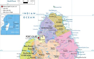
Montitius Africa map highlights various features, including notable landforms, landmarks, and populated areas. The map features diverse terrains such as mountains, beaches, and forests, which are essential for understanding the island’s geography. Major landmarks include the Black River Gorges National Park, Le Morne Brabant, and Chamarel Waterfall, offering cultural and natural significance. The island is dotted with key cities and towns, with Port Louis serving as the capital and largest city. Other important towns include Curepipe, Quatre Bornes, and Rose Hill, each contributing to the island’s economic and social landscape. These features collectively portray Mauritius as a vibrant destination with a rich mix of natural beauty and urban development.
Natural Landmarks
Map features and landmarks on the Mauritius Africa map highlight the diverse natural and cultural attractions of this island nation. Natural landmarks such as the Black River Gorges National Park showcase lush forests and rare wildlife, while the iconic Le Morne Brabant mountain is a symbol of cultural heritage and resilience. Other notable natural features include the Chamarel Waterfall and the Seven Colored Earths, which attract tourists from around the world. These landmarks not only define the island’s scenic beauty but also play an important role in its ecological and cultural identity.
Political Boundaries and Administrative Divisions
Political boundaries and administrative divisions define the borders and governance structures within a country. In the context of Mauritius, an island nation in Africa, these divisions play a vital role in organizing its political landscape, local administration, and regional identity. Understanding the map of Mauritius and its administrative boundaries provides insight into the country’s geographical and political organization.
Provinces and Districts
In the context of the Mauritius Africa map, understanding political boundaries and administrative divisions is essential for comprehending the country’s governance structure. Mauritius is an island nation divided into several provinces, each serving as a key administrative region. These provinces are further subdivided into districts, which function as local administrative units responsible for various government functions and public services. The provinces help organize political representation and regional development initiatives, while districts facilitate localized governance and resource management. This hierarchical division ensures effective administration across Mauritius, promoting social cohesion and administrative efficiency within the nation’s geographic layout.
Bordering Countries and Bodies of Water
Mauritius is an island nation located in the Indian Ocean, off the southeastern coast of Africa. It is situated approximately 2,000 kilometers (1,240 miles) away from the eastern coast of the continent. The country is an independent republic and is not bordered by any other countries, being entirely surrounded by water. As a sovereign island state, Mauritius is divided administratively into several districts, each governed by local authorities. The nation’s political boundaries are confined to its maritime borders, which encompass its territorial waters, exclusive economic zone, and contiguous zone. The surrounding bodies of water include the Indian Ocean, which provides vital maritime links and influences the country’s climate and economy. Its strategic location makes it an important region within the African continent, with unique geographic and political features that distinguish it from mainland African countries.
Physical Geography and Environment
Physical geography and environment play a crucial role in shaping the landscape and ecological systems of regions around the world. Mauritius, an island nation in Africa, is renowned for its diverse terrain, lush vegetation, and vibrant coastal ecosystems. Understanding the physical features and environmental dynamics of Mauritius provides insight into its natural beauty and the challenges it faces in preserving its unique environment.
Climate Zones
Mauritius, an island nation located in the Indian Ocean off the southeastern coast of Africa, features diverse physical geography and climate zones. Its landscape is characterized by volcanic mountains, lush forests, and pristine beaches, contributing to its unique environment. The central region is dominated by the volcanic Mount Pouce and other volcanic hills that influence local weather patterns. Surrounding these highlands are coral reefs and low-lying coastal plains, creating contrasting habitats across the island. Mauritius’s climate is generally tropical, with distinct wet and dry seasons, but variations occur due to elevation and proximity to the ocean. The island experiences a tropical maritime climate, resulting in warm temperatures and high humidity throughout the year. Different climate zones on the island support diverse ecosystems, including rainforests, dry forests, and coastal wetlands, making Mauritius a rich environment with considerable ecological significance. The geographic features and climate zones are crucial for understanding the island’s environmental dynamics and its map within Africa.
Vegetation and Ecosystems
Mauritius, an island nation in the Indian Ocean off the southeastern coast of Africa, features a diverse physical geography and rich ecosystems. The island’s landscape includes volcanic formations, mountain ranges such as the Pitons, and coastal plains that support varied vegetation and ecosystems. Its central plateau is characterized by lush forests and fertile lands, while the coastal regions are dotted with sandy beaches, coral reefs, and lagoons.
The island’s vegetation varies from tropical rainforests and mangroves to savannas and cultivated lands. These ecosystems are home to numerous endemic and native species, including unique bird, plant, and marine life. The coral reefs surrounding Mauritius are vital for supporting marine biodiversity and protecting the shoreline from erosion. Overall, Mauritius exemplifies a complex interplay of volcanic terrain, lush vegetation, and vibrant ecosystems, making it a significant subject of study in physical geography and environmental conservation in Africa.
Wildlife Habitats
Mauritius, located in the Indian Ocean off the southeastern coast of Africa, is renowned for its diverse physical geography and rich wildlife habitats. The island features volcanic landscapes, lush forests, and pristine beaches, creating a variety of ecological zones. The central plateau is characterized by rugged terrains and rolling hills, while the coastal areas are lined with coral reefs and sandy shores. These diverse environments support a wide array of flora and fauna, some of which are endemic to the island.
The island’s natural habitats include dense tropical forests that are home to unique bird species like the Mauritius Kestrel and the Pink Pigeon. Coastal mangroves and lagoons provide important breeding and feeding grounds for marine life and waterfowl. Protected areas such as Black River Gorges National Park help conserve these habitats and preserve the island’s biodiversity. Overall, the physical geography of Mauritius plays a vital role in shaping its wildlife habitats and environmental landscape.
Economic and Cultural Significance of the Map
The map of Mauritius in Africa holds great economic and cultural significance, serving as a vital tool for understanding the island nation’s geographic, historical, and societal context. It highlights the strategic location of Mauritius in the Indian Ocean, facilitating trade and maritime connectivity. Additionally, the map reflects the rich cultural diversity of the island, showcasing its heritage, language, and traditions that have evolved through centuries of interaction among different communities. Overall, the map is a valuable resource for appreciating Mauritius’s unique identity within the African continent and its global importance.
Tourism Sites
The Mauritius Africa map holds significant economic and cultural value, serving as a vital tool for understanding the island nation’s position within the continent and the world. Economically, it highlights Mauritius’s strategic location for international trade and maritime activities, fostering connections that boost its tourism, import-export industries, and economic growth. Culturally, the map reflects the diverse heritage of Mauritius, showcasing the influence of African, Asian, European, and Creole cultures that shape its unique identity. It also underscores important tourism sites, such as beaches, nature reserves, and historical landmarks that attract visitors and promote cultural exchange. Overall, the map is a visual representation that underscores Mauritius’s significance both as a prosperous economic hub and a vibrant, multicultural society.
Historical Landmarks
The Mauritius Africa map holds immense economic and cultural significance, serving as a vital tool for understanding the island’s role within the broader African context. It highlights key geographical features that influence trade, tourism, and regional cooperation, contributing to the nation’s economic development. Additionally, the map reflects the rich cultural diversity of Mauritius, showcasing historical landmarks and cultural sites that emphasize its unique heritage.
- Economic Significance:
- Facilitates trade routes and maritime navigation around the Indian Ocean.
- Supports tourism by pinpointing popular destinations and natural attractions.
- Assists in regional economic cooperation and development planning.
- Cultural Significance:
- Displays locations of historical landmarks and heritage sites.
- Highlights cultural diversity through various settlements and religious sites.
- Offers insights into traditional customs and historical narratives tied to specific geographic areas.
- Historical Landmarks:
- Aapravasi Ghat – a UNESCO World Heritage Site symbolizing indentured labor migration.
- Le Morne Cultural Landscape – a historic site representing resistance and cultural identity.
- Grand Bassin (Ganga Talao) – a sacred Hindu pilgrimage site with cultural and religious importance.
- Citadelle Fort Adelaide – an 1834 fortress offering historical insights and panoramic views.
Economic Regions and Activities
The map of Mauritius offers valuable insights into the island nation’s economic and cultural landscape. It highlights key economic regions, such as the Port Louis metropolitan area, which is a hub for finance, commerce, and industry, contributing significantly to the country’s GDP. Coastal regions are vital for tourism, with areas like Grand Baie and Flic En Flac hosting numerous resorts, beaches, and recreational activities that attract visitors worldwide. Internally, agricultural zones are essential for sugarcane production, which historically served as a mainstay of Mauritius’s economy. Culturally, the map reveals diverse communities including Indo-Mauritians, Creoles, Chinese, and others, reflecting the rich multicultural heritage that influences local customs, festivals, and cuisine. These economic regions and activities are interconnected, shaping the island’s identity and development trajectory, and emphasizing the importance of geographic understanding for sustainable growth and cultural preservation.


0 Comments