.jpeg")
Geographical Location of Algeria
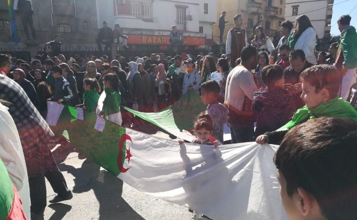
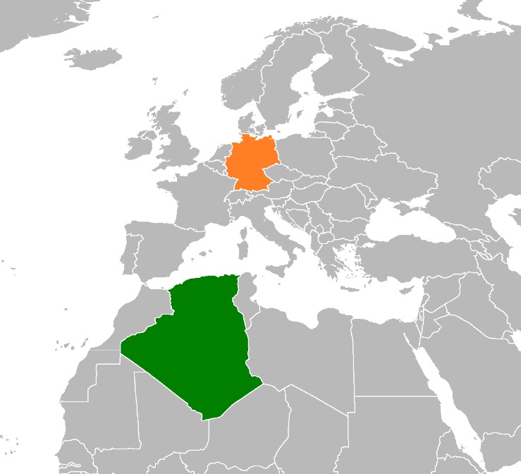
Algeria is a vast country located in North Africa, bordered by the Mediterranean Sea to the north. It shares land borders with Tunisia, Libya, Niger, Mali, Mauritania, Western Sahara, and Morocco. Positioned at the crossroads between Africa and Europe, Algeria’s strategic location makes it a significant region for trade, culture, and geographical diversity. Its expansive territory encompasses a variety of landscapes, from coastal plains to extensive desert regions.
Position in Africa
Algeria is a country located in the northern part of Africa, occupying the entire northern region along the Mediterranean coast. It is the largest country in Africa by land area, making it a significant geographical marker on the continent. Algeria shares borders with Tunisia, Libya, Niger, Mali, Mauritania, Western Sahara, and Morocco. Its strategic position links the Maghreb region with the rest of Africa and the Mediterranean, giving it a vital role in regional geopolitics and trade. The country’s diverse landscape includes beaches, mountains, and vast deserts, reflecting its extensive geographical extent within Africa.
Coordinates and Boundaries
Algeria is a country located in North Africa, positioned along the Mediterranean Sea. It is the largest country in Africa by land area, offering a diverse geographical landscape including deserts, mountains, and coastal plains.
The coordinates of Algeria are approximately 28° to 37° North latitude and 3° to 12° East longitude. These coordinates place Algeria in the Maghreb region, sharing borders with several neighboring countries.
- Bordering Countries:
- Tunisia to the northeast
- Libya to the east
- Niger to the southeast
- Mali and Mauritania to the southwest
- Western Sahara to the west
- Morocco to the northwest
- Boundaries:
- Northern boundary: Mediterranean coastline approximately 1,200 kilometers long
- Land boundaries total about 6,313 kilometers
Surrounding Countries and Borders
Algeria, located in North Africa, is surrounded by several countries that shape its geographical and cultural landscape. Sharing borders with Tunisia, Libya, Niger, Mali, Mauritania, Western Sahara, and Morocco, Algeria’s position influences its regional relationships and accessibility. Understanding its neighboring countries provides insight into the region’s dynamics and Algeria’s role within it.
Northern Border: Mediterranean Sea
Algeria is located in North Africa and shares borders with several countries. To the north, it is bordered by the Mediterranean Sea, providing it with a significant coastline that is crucial for trade and access to maritime routes. Algeria’s neighboring countries include Tunisia and Libya to the northeast, Niger to the southeast, Mali and Mauritania to the southwest, Western Sahara to the west, and Morocco to the northwest. The northern border along the Mediterranean Sea plays an essential role in Algeria’s geographical and economic interactions, connecting it to a broader Mediterranean region.
Bordering Countries: Tunisia, Libya, Niger, Mali, Mauritania, Western Sahara, and Morocco
Algeria is located in North Africa and is the largest country on the continent by land area. It shares its borders with several neighboring countries, including Tunisia, Libya, Niger, Mali, Mauritania, Western Sahara, and Morocco. These bordering nations influence Algeria’s geographic, cultural, and economic relations within the region. The country’s strategic position allows it to serve as a significant link between the Mediterranean coast and the interior of the African continent, contributing to its role in regional politics and trade.
Physical Features and Landscape
Algeria, located in North Africa, boasts a diverse and striking landscape shaped by its vast size and varied geography. From the expansive Sahara Desert to lush coastal plains and rugged mountain ranges, the country’s physical features create a rich tapestry of natural beauty. This variety in landscape not only influences the climate and ecosystems but also plays a significant role in shaping Algeria’s cultural and economic activities.
Coastal Region
The coastal region of Algeria stretches along the Mediterranean Sea, featuring a diverse and picturesque landscape. This area is characterized by beautiful sandy beaches, rocky shores, and rugged cliffs that attract many visitors. The terrain transitions from flat plains near the coast to more mountainous areas as you move inland, with the Tell Atlas mountain range dominating the landscape. The region benefits from a Mediterranean climate, with mild, wet winters and hot, dry summers. The diverse physical features support a rich variety of flora and fauna, making the coastal region an important area for agriculture, tourism, and biodiversity.
The Sahara Desert
The Sahara Desert in Algeria is a vast and striking landscape characterized by expansive dunes, rocky plateaus, and sparse vegetation. It covers a significant portion of northern Africa, extending into the southern regions of Algeria, creating a harsh yet captivating environment. The landscape features towering sand dunes that can reach heights of over 180 meters, giving the desert a dynamic and ever-changing appearance due to shifting sands. Alongside the dunes, there are areas of gravel plains, rocky outcrops, and some mountainous regions, such as the Hoggar Mountains, which rise abruptly from the surrounding desert. The landscape is marked by extreme temperatures, with scorching hot days and surprisingly chilly nights, emphasizing its arid and challenging conditions. Overall, the Sahara in Algeria presents a stunning and extreme environment shaped by natural forces over thousands of years.
Mountain Ranges and Plateaus
Algeria, located in North Africa, features diverse physical features and landscapes that shape its geography. The country is characterized by vast deserts, expansive plains, and mountain ranges that add to its scenic variety. The Sahara Desert dominates much of southern Algeria, creating a harsh yet stunning landscape with towering sand dunes and rocky plateaus.
The Atlas Mountain Range extends across northern Algeria, serving as a prominent geographic feature that separates the coastal regions from the interior. This mountain range includes the Tell Atlas, which runs parallel to the Mediterranean coast, and the Saharan Atlas further south. These ranges are rugged, with peaks that reach significant altitudes, providing a dramatic contrast to the surrounding plains and deserts.
Algeria also contains several prominent plateaus, such as the Hautes Plaines (High Plateaus) situated between the Tell Atlas and the Sahara Desert. These elevated flatlands are characterized by semi-arid conditions and serve as important agricultural zones. The landscape’s diversity, from mountainous regions to flat plateaus and expansive deserts, contributes to Algeria’s complex and varied terrain.
Strategic Significance
Algeria’s strategic significance lies in its unique geographical position as the largest country in Africa, bordered by the Mediterranean Sea to the north and sharing borders with several key nations. Its location offers vital access to maritime trade routes, natural resources, and regional influence. Understanding Algeria’s geographic placement is essential to appreciating its role in regional stability, economic development, and geopolitical dynamics within North Africa and beyond.
Access to the Mediterranean Sea
Algeria’s strategic significance is heavily tied to its geographic location, particularly its access to the Mediterranean Sea. This access provides the country with vital maritime routes that facilitate international trade, naval presence, and economic development. Control over its coastline allows Algeria to engage in Mediterranean commerce, boosting its economy through port activities and maritime industries. Furthermore, the Mediterranean shoreline offers Algeria strategic military advantages, enabling it to oversee key maritime corridors and enhance regional security. The country’s position as a gateway between Africa and Europe underscores its importance in regional stability, economic connectivity, and geopolitical influence in the Mediterranean basin.
Trade Routes and Regional Influence
Algeria’s strategic location in North Africa positions it as a crucial hub for regional stability and international trade. Situated along the Mediterranean coast, it serves as a gateway between Africa, Europe, and the Middle East, facilitating the movement of goods and ideas across these regions. The country’s proximity to vital maritime routes enhances its importance in global trade networks, especially for commodities like oil and gas that are critical to the international economy.
Algeria’s extensive coastline and access to the Mediterranean Sea allow it to control significant maritime passages, making it a key player in regional and global shipping lanes. Its location enables it to influence regional geopolitics and economics, serving as an anchor for regional alliances and trade agreements. Additionally, Algeria’s positioning supports its aspirations to be a regional leader, leveraging its natural resources and geographic advantages to extend influence across North Africa and beyond.


0 Comments