.jpeg")
Geographical Overview of Algeria
Algeria, the largest country in Africa, is renowned for its diverse and striking landscape. Situated in North Africa, it borders the Mediterranean Sea to the north, providing it with a rich coastal region. The country features a varied geography that includes vast deserts, mountain ranges, fertile plains, and rugged plateaus. These diverse landscapes contribute to Algeria’s scenic beauty and influence its climate, ecosystems, and human settlements across the nation.
Location and Size
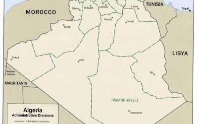
Algeria is situated in the northern part of Africa, bordered by the Mediterranean Sea to the north, Tunisia and Libya to the northeast, Niger and Mali to the south, Mauritania and Western Sahara to the southwest, and Morocco to the west. Covering an area of approximately 2.38 million square kilometers, it is the largest country in Africa and the tenth largest in the world. The country’s vast size encompasses a diverse landscape that includes the expansive Sahara Desert in the south, the fertile plains and coastal regions in the north, and the rugged Atlas Mountains. This geographical diversity significantly influences Algeria’s climate, ecosystems, and human settlement patterns, making its landscape both varied and unique.
Bordering Countries
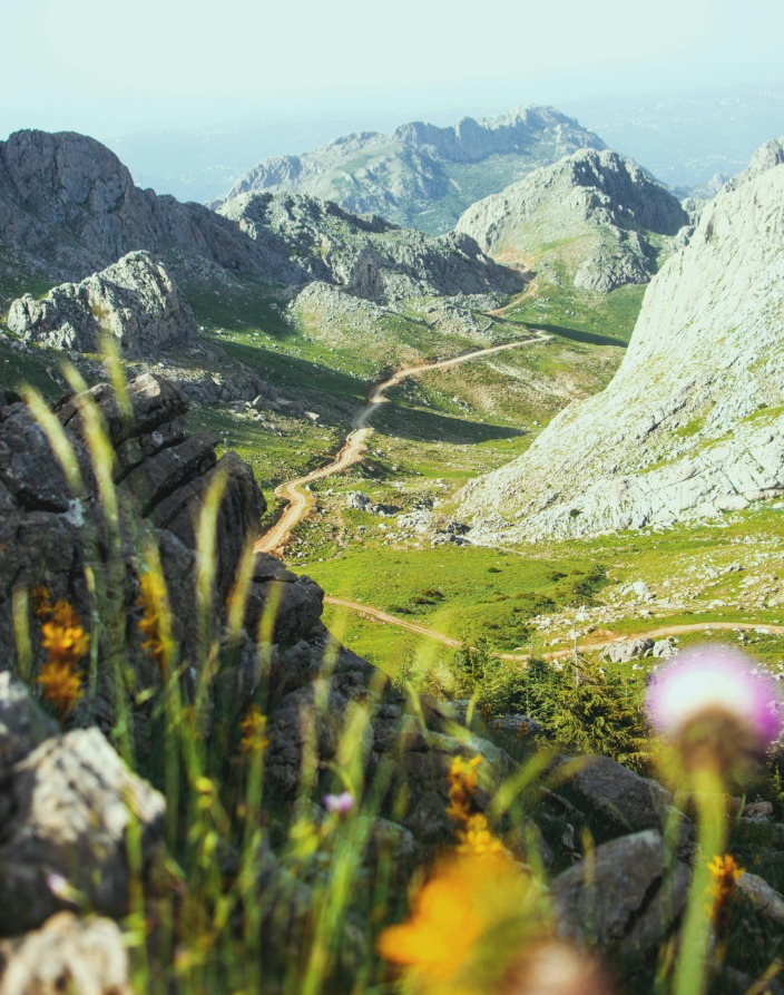
Algeria, located in North Africa, is the largest country on the continent, featuring diverse geographical landscapes that range from vast deserts to lush coastal plains. Its terrain includes the Sahara Desert in the south, the high plateau in the center, and the Tell Atlas mountain range along the Mediterranean coast. The country’s varied topography influences its climate and ecosystems, contributing to a rich natural environment.
Algeria shares borders with several countries: to the north, it is bounded by the Mediterranean Sea, providing a significant coastline. Land borders include Tunisia and Libya to the northeast, Niger to the southeast, Mali and Mauritania to the southwest, Western Sahara to the west, and Morocco to the northwest. These neighboring countries contribute to Algeria’s geographic and cultural diversity, shaping its landscape and regional interactions.
Major Cities and Urban Areas
Algeria, located in North Africa, boasts a diverse landscape that encompasses a variety of geographical features. The country features expansive deserts, notably the Sahara Desert in the south, as well as fertile coastal plains and rugged mountainous regions in the north. The Atlas Mountains stretch across northern Algeria, providing dramatic scenery and influencing the climate. The northern coast along the Mediterranean Sea offers a lush, green environment contrasted by the arid desert interior, creating a fascinating landscape that varies significantly across regions.
Major cities and urban areas in Algeria are predominantly situated along the northern coast and in key inland regions. These urban centers serve as cultural, economic, and political hubs of the country.
- Algiers – the capital city and the largest urban center, located along the Mediterranean coast.
- Oran – a major port city on the northwest coast, known for its vibrant culture and history.
- Constantine – an inland city famous for its dramatic canyon setting and historical significance.
- Annaba – a port city in the northeast, playing an important role in industry and trade.
- Sétif – an important commercial and agricultural city located inland, east of Algiers.
- Blida – situated near the Mitidja Plain, known for agriculture and its proximity to Algiers.
Topographical Features
Algeria’s landscape is characterized by a diverse array of topographical features that shape its natural beauty and geographical identity. From vast deserts to lush mountains, the country’s topography offers a fascinating glimpse into its varied terrain. Understanding these features provides insight into Algeria’s climate, ecosystems, and cultural regions, making it a vital aspect of its overall landscape.
Atlas Mountain Range
The Atlas Mountain Range is a prominent topographical feature that significantly shapes the landscape of Algeria. Extending across North Africa, these mountains form a natural barrier between the coastal plains and the interior desert regions. In Algeria, the Atlas Mountains are divided into several subranges, including the Tell Atlas along the Mediterranean coast, the Saharan Atlas further inland, and the Saharan Atlas Saghir. These mountains are characterized by rugged peaks, deep valleys, and fertile plateaus that support diverse flora and fauna. The Atlas Range influences the climate of the region, creating wetter conditions in the northern areas and contributing to the arid environment of the Sahara Desert to the south. Overall, the Atlas Mountains play a crucial role in the country’s topography, climate, and ecological diversity, shaping Algeria’s diverse landscape.”
Sahara Desert
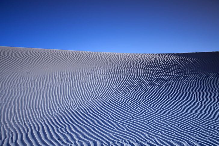
The landscape of Algeria is characterized by the vast and diverse topographical features that define its geography. The Sahara Desert covers a significant portion of southern Algeria, forming part of the larger Sahara Basin. This expansive desert area features endless sand dunes, rugged rocky plateaus, and dry riverbeds, creating a striking and arid environment. North of the desert, the terrain transitions to the Tell Atlas mountain range, which includes high peaks, fertile valleys, and lush forests. The Sahara’s terrain is marked by features such as erg (sand dunes), hamadas (rocky plateaus), and oases that provide vital water sources and support local ecosystems. Overall, Algeria’s landscape exhibits a remarkable variety, from the scorching desert expanses to the mountainous and greener regions in the north, illustrating the country’s diverse topography.
Tell Atlas and Tell Plain
Algeria’s landscape is characterized by diverse topographical features, including the prominent Tell Atlas and the Tell Plain. The Tell Atlas is a mountain range that runs along the northern coast of Algeria, featuring rugged peaks, deep valleys, and fertile lands that support agriculture and dense populations. This region is part of the larger Atlas mountain system in North Africa and serves as a natural barrier between the Mediterranean Sea and the interior deserts. The Tell Plain is a low-lying, fertile area situated at the foot of the Tell Atlas. It extends along the northern coast and is the most densely populated and agriculturally productive region of the country. The plain is characterized by its rich soils, moderate climate, and extensive irrigation, making it the agricultural heartland of Algeria. Together, the Tell Atlas and the Tell Plain form a vital geographical zone that significantly influences Algeria’s climate, agriculture, and settlement patterns.
Climate Variations
Algeria’s diverse landscape is shaped by significant climate variations that influence its environment and inhabitants. From the arid expanses of the Sahara Desert to lush coastal regions, the country’s climate zones create unique ecological conditions and affect agricultural practices, wildlife, and daily life. Understanding these climate variations is essential to grasp the complexity and beauty of Algeria’s landscape.
Mediterranean Climate in the North
The climate variations across Algeria’s landscapes are notably diverse, with the Mediterranean climate predominating in the northern regions. This climate is characterized by mild, wet winters and hot, dry summers, which support lush vegetation and a rich variety of flora and fauna. The northern coastal areas experience regular rainfall, contributing to fertile soils suitable for agriculture, as well as dense forests and agricultural terraces. These conditions create a distinctive environment compared to the more arid interior and southern parts of the country. The Mediterranean climate in northern Algeria plays a crucial role in shaping the landscape, supporting urban development, farming, and natural ecosystems along the coastline.
Arid and Semi-Arid Conditions in the South
The southern region of Algeria is characterized by significant climate variations, primarily dominated by arid and semi-arid conditions. These environmental factors shape the landscape, resulting in vast expanses of desert landscapes such as the Sahara Desert. The climate’s intensity leads to scarce and irregular precipitation, making the land challenging for agriculture and human settlement. Despite these harsh conditions, the region features unique geological formations, dunes, and sparse vegetation adapted to the extreme climate. The variability in climate influences the biodiversity and the traditional lifestyles of the nomadic communities living in the southern part of Algeria. Understanding these climate patterns is essential for managing resources and developing sustainable strategies in this arid landscape.
Highland Climate and Weather Patterns
Algeria’s diverse landscape is greatly influenced by its climate variations, Highland climate, and weather patterns. The country’s varied topography, which includes mountains, plateaus, and deserts, results in distinct climatic zones. The Highland regions, particularly the Saharan Atlas and the Tell Atlas, experience a more temperate climate with cooler temperatures and higher rainfall compared to the arid Sahara Desert. These areas benefit from seasonal weather patterns, including winter rains and summer dry spells. In contrast, the lowland and desert regions are characterized by extreme temperature variations, intense heat in the summer, and significant dryness throughout the year. The weather patterns in Algeria are driven by Mediterranean influences along the coast and continental or desert influences inland, leading to unpredictable weather events such as dust storms and occasional rainfall in the mountains. Overall, the climate variations shape Algeria’s rich and diverse landscape, affecting its agriculture, vegetation, and settlement patterns.
Natural Landmarks and Conservation Areas
Algeria’s landscape is renowned for its stunning natural landmarks and protected conservation areas that showcase the country’s diverse geography. From vast deserts and towering mountain ranges to lush oases and coastal regions, these natural sites highlight Algeria’s rich environmental heritage. Preserving these landscapes is essential for maintaining biodiversity, supporting local communities, and promoting sustainable tourism.
Hoggar Mountains
The Hoggar Mountains, also known as the Ahaggar Mountains, are a stunning natural landmark located in the Sahara Desert of southern Algeria. This volcanic mountain range is characterized by its rugged peaks, deep valleys, and unique rock formations, making it a prominent feature of Algeria’s diverse landscape. The region is home to several rare plant and animal species, some of which are endemic to the area, highlighting its ecological significance.
Conservation efforts in the Hoggar Mountains are vital to preserving its fragile ecosystem. The area has been designated as a protected natural reserve to safeguard its unique geological features and biodiversity. These efforts aim to prevent environmental degradation caused by human activities such as tourism and climate change. Visitors are encouraged to appreciate the natural beauty responsibly, ensuring that future generations can continue to enjoy this majestic landscape.
Tassili n’Ajjer National Park
Tassili n’Ajjer National Park is one of Algeria’s most remarkable natural landmarks, renowned for its stunning rock formations, ancient cave paintings, and diverse ecosystems. Located in the Sahara Desert, this UNESCO World Heritage site showcases the unique geological features created by millennia of wind and water erosion, resulting in dramatic sculptures and arches that captivate visitors. The park is also an important conservation area, protecting rare flora and fauna adapted to the harsh desert environment, including various endemic species. Its vast expanse of sandstone plateaus and natural arches highlights the deep geological history of Algeria’s landscape, making it a vital region for both ecological preservation and cultural heritage. Visitors to Tassili n’Ajjer can explore its labyrinth of caves, archaeological sites, and rugged terrains while appreciating the importance of conserving such an extraordinary natural environment within Algeria’s diverse landscape.
Saharan Oases and Lagoons
Algeria boasts a diverse and stunning landscape that features natural landmarks and conservation areas, each highlighting the country’s rich ecological heritage. Among these are the breathtaking Saharan oases, which serve as vital ecological and cultural hubs within the expansive Sahara Desert. These oases, such as the Tamanrasset Oasis, provide vital habitats for various flora and fauna, and are crucial for sustaining local communities. Additionally, Algeria is home to numerous lagoons, like the beautiful Chott El Djerid and the unique Boudels Lagoon, which create surreal landscapes characterized by salt flats, shallow waters, and mineral deposits. These lagoons not only contribute to the country’s ecological diversity but also attract tourists and scientists alike. Conservation efforts in Algeria focus on protecting these fragile environments from desertification and human impact, ensuring that their natural beauty and ecological importance are preserved for future generations. Overall, Algeria’s landscapes exemplify a harmonious blend of desert expanses, lush oases, and vibrant lagoons, making it a fascinating destination for nature enthusiasts and conservationists.


0 Comments