
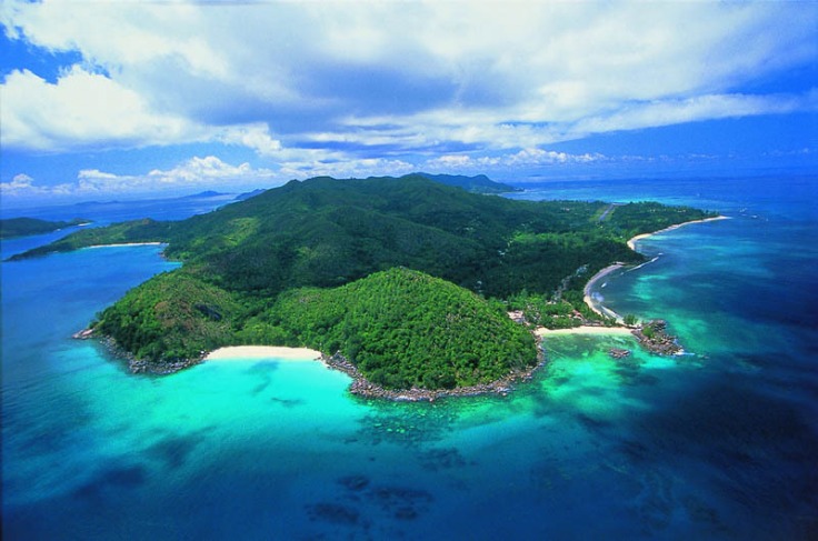
Overview of Seychelles Islands Map
The Seychelles Islands Map provides a comprehensive overview of this stunning archipelago located in the Indian Ocean. It highlights the diverse islands, their geographical features, and key locations, making it easier for travelers and explorers to navigate and understand the layout of these tropical paradise islands. This map serves as an essential tool for planning trips, discovering points of interest, and gaining a better appreciation of Seychelles’ natural beauty and unique topography.
Geographical Location
The Seychelles Islands map provides a comprehensive view of this stunning archipelago located in the Indian Ocean. It highlights the individual islands, their relative positions, and key geographical features across the group. The map is an essential tool for understanding the layout and distribution of the islands, from the main granitic islands to the smaller coral cays and atolls.
Geographically, Seychelles is situated approximately 1,500 kilometers east of mainland Africa, northeast of Madagascar. The islands are divided into two main groups: the Inner Islands, which are mainly granitic and have rugged, mountainous terrain, and the Outer Islands, primarily coral atolls with flat, low-lying features. The location offers a tropical climate, with a lush landscape characterized by dense rainforests, beautiful beaches, and vibrant marine life, making Seychelles a popular destination for nature lovers and travelers seeking pristine environments.
Size and Extent of the Map
The Seychelles Islands Map provides a comprehensive view of the archipelago’s geographical layout, showcasing its numerous islands scattered across the Indian Ocean. It highlights the positioning and relationships between the main islands such as Mahé, Praslin, and La Digue, along with smaller surrounding islands. The map is useful for understanding the distribution of landmasses and the relative distances between islands, which is important for navigation and travel planning.
The total area covered by the Seychelles Islands is approximately 459 square kilometers, with the main islands contributing the majority of this space. The map illustrates the expansive spread of these islands, stretching over a wide oceanic area of about 1.4 million square kilometers. This extensive extent emphasizes the archipelago’s significance in the Indian Ocean, providing a clear perspective on the scale and organic layout of the Seychelles and aiding in geographical and tourism-related exploration.
Key Features Highlighted on the Map
The Seychelles Islands Map provides a comprehensive overview of the archipelago’s geography, key locations, and significant features. This detailed map helps visitors and researchers understand the layout of these islands, including major islands, towns, and natural landmarks.
- Location of major islands such as Mahé, Praslin, La Digue, and Silhouette Island.
- Highlighting major towns and cities including Victoria, Baie Sainte Anne, and Anse aux Pins.
- Beaches, national parks, and protected areas like Vallée de Mai and Morne Seychellois National Park.
- Transport routes including airports, ports, and main roads connecting the islands.
- Natural features such as coral reefs, lagoons, and mountain ranges.
Major Islands and Their Maps
The Seychelle Islands are a captivating archipelago known for their stunning landscapes and diverse ecosystems. Exploring these islands through detailed maps provides valuable insight into their geography, locations of key landmarks, and natural features. Understanding the layout of the Seychelle Islands enhances the experience for travelers, researchers, and anyone interested in this beautiful region.
Main Islands Overview
The Seychelles islands are a beautiful archipelago located in the Indian Ocean, known for their stunning beaches, diverse marine life, and lush tropical landscapes. Exploring the main islands and their maps provides a comprehensive understanding of this remote paradise and helps visitors navigate and appreciate its natural beauty.
Major Islands and Their Maps
The Seychelles consists of over 100 islands, but the main islands are Antigua, Mahé, Praslin, La Digue, and Silhouette. Detailed maps of these islands highlight key locations, hiking trails, beaches, and points of interest, making them essential tools for travelers and explorers.
Main Islands Overview
- Mahé – The largest island, home to the capital Victoria. It features stunning beaches, national parks, and the lush Mount Seychelles. Maps of Mahé typically show major roads, attractions like Beau Vallon beach, and hiking routes.
- Praslin – Known for its Vallée de Mai Nature Reserve, a UNESCO World Heritage site. Maps emphasize protected areas, beaches such as Anse Lazio, and resorts scattered along the coastline.
- La Digue – Famous for its traditional ox-cart transportation, granite boulders, and pristine beaches like Anse Source d’Argent. Maps focus on bicycle routes, trails, and scenic viewpoints.
- Silhouette – A mountainous island with dense forests and luxury resorts. Its maps highlight hiking trails, viewpoints, and conservation zones.
Overall, the Seychelles islands’ maps serve as vital guides, helping visitors discover the natural, cultural, and recreational highlights across these main islands, ensuring an enriching experience in this tropical paradise.
Mahé Island Map
The Seychelles islands are renowned for their stunning landscapes and diverse marine life, with Mahé being the largest and most important island. A detailed Mahé Island map provides valuable insights into the island’s geography, key locations, and transportation routes. It highlights notable towns such as Victoria, the capital city, along with beautiful beaches, mountain ranges like Morne Seychellois, and attractions such as the Seychelles National Botanical Gardens. The map serves as a helpful guide for visitors exploring Mahé, offering directions to resorts, parks, and scenic viewpoints. Overall, a comprehensive map of Mahé Island enhances the experience of discovering the natural beauty and cultural sites of the Seychelles, making it an essential resource for travelers and explorers alike.
Praslin Island Map
The Seychelles islands map provides a detailed overview of the archipelago’s major islands, including Praslin Island, which is renowned for its natural beauty and lush landscapes. Praslin is the second-largest island in Seychelles and features iconic sites such as Vallée de Mai Nature Reserve, a UNESCO World Heritage site, home to the rare Coco de Mer palm. The map of Praslin Island highlights key locations, beaches, and points of interest, helping visitors navigate the island’s scenic spots, resorts, and local villages. Overall, the map offers a comprehensive guide for travelers seeking to explore the diverse terrain and vibrant ecosystems of Praslin within the Seychelles islands.]
La Digue Island Map
The Seychelles islands are renowned for their stunning landscapes, pristine beaches, and vibrant ecosystems. An essential tool for exploring these beautiful islands is a detailed map, which provides valuable information on Major Islands, including La Digue Island. La Digue, one of the most picturesque islands in the Seychelles, is famous for its natural beauty and tranquil atmosphere. Having a map of La Digue Island helps visitors navigate its charming villages, scenic beaches, and lush inland trails effectively.
When exploring the Seychelles islands map, La Digue stands out with several noteworthy locations to visit:
- Anse Source d’Argent – One of the most photographed beaches in the world, known for its pink sand and granite boulders.
- Veuve Nature Reserve – A protected area home to rare bird species and tropical flora.
- Union Estate Park – A popular spot for visiting giant tortoises and learning about local agricultural history.
- Bel Ombre Beach – A quiet, less crowded beach perfect for relaxing and snorkeling.
- La Passe Village – The main town offering accommodations, shops, and transportation hubs.
Using a detailed map of La Digue Island enhances the experience by helping visitors plan routes, find key attractions, and enjoy the island’s natural beauty to the fullest. Overall, the Seychelles islands map, with a focus on La Digue, is an invaluable resource for travelers seeking an authentic and memorable adventure in the Seychelles.
Other Notable Islands and Their Maps
The Seychelles Islands are an archipelago of 115 islands located in the Indian Ocean, renowned for their stunning natural beauty and unique biodiversity. Detailed maps of these major islands, such as Mahé, Praslin, and La Digue, offer invaluable guidance for travelers and researchers alike, showcasing topographical features, beaches, and inland attractions. These maps highlight important locations, transportation routes, and conservation areas, making them essential tools for navigation and planning.
Other notable islands within the Seychelles archipelago, including Silhouette Island, Fregate Island, and Denis Island, also have specialized maps that emphasize their distinct landscapes, resorts, and natural reserves. These maps often focus on aspects such as hiking trails, diving sites, and exclusive lodges, supporting eco-tourism and sustainable travel initiatives.
Overall, Maps of the Seychelles Islands serve as crucial resources, enhancing the understanding of this diverse archipelago. They aid in promoting tourism, preserving ecological sites, and facilitating scientific research, ensuring that visitors can explore and appreciate the Seychelles’ unique environment responsibly.
Map Features and Details
The map of the Seychelles Islands offers a comprehensive view of its diverse landscapes and intricate geographic features. By exploring the details on the map, travelers and explorers can better understand the archipelago’s topography, coastline, and key landmarks. These map features provide essential insights that enhance navigation, planning, and appreciation of the region’s natural beauty and unique ecological characteristics.
Topography and Elevation
The map of the Seychelles Islands provides detailed insights into the diverse features and topography of this archipelago. It highlights the various landforms, including the flat coastal areas, rugged hills, and mountainous regions across the islands. The topography varies significantly between islands, with some, like Mahe and Praslin, showcasing prominent elevations and lush terrains. Elevation data on the map helps illustrate the height differences, revealing peaks such as Morne Blanc and other prominent summits. These features are crucial for understanding the landscape, planning excursions, and appreciating the natural beauty of the Seychelles. The map’s detailed representation of terrain and elevation enhances navigation and offers valuable information for visitors seeking outdoor adventures or exploring the unique geography of each island.
Coastlines and Beaches
The Seychelles Islands map showcases a variety of features and details that highlight the region’s natural beauty and geographic diversity. Coastlines are prominent on the map, illustrating the extensive sandy beaches and rugged shorelines that border the islands, often marked with distinct lines and shading to indicate different coast types. Beaches are highlighted with symbols and textures that emphasize popular spots for swimming, sunbathing, and water activities. The map also details intricate coastlines with numerous coves, bays, and peninsulas, reflecting the islands’ rugged marine landscape. These features are essential for understanding the layout of the islands and planning travel routes or exploring the coastal environment. Overall, the map provides clear visual cues about the coastline’s shape, size, and prominent beach areas, essential for visitors and navigation alike.
Terrain Types and Vegetation
The Seychelles Islands map showcases a diverse array of features and details that highlight the archipelago’s unique geography. These maps typically depict various terrain types, including mountainous regions, coastal plains, and small inland hills. Terrain features such as rugged cliffs, sandy beaches, and coral reefs are also prominently illustrated, providing a comprehensive view of the islands’ natural landscape. The vegetation varies across different areas, with lush tropical forests covering many of the main islands, including Mahé and Praslin. In addition to dense forests, some regions are characterized by open grasslands and garden-like landscapes, often dotted with botanical gardens and protected natural parks. These detailed map features help visitors and researchers understand the diverse ecological zones and terrain configurations that define the Seychelles archipelago.
Marine Areas and Reefs
The Seychelles Islands map provides detailed information about various map features, marine areas, and reefs that are crucial for navigation, exploration, and understanding the region’s oceanic landscape. These maps highlight key coastal features, including sandy beaches, rocky outcrops, and mangrove areas, offering a comprehensive view of the islands’ geography. Marine areas are often delineated to indicate protected zones, shipping lanes, and areas of significant maritime activity. Reefs are prominently marked to showcase coral formations, atolls, and submerged structures that are vital for marine biodiversity and tourism. The inclusion of detailed reef locations helps in safe anchoring and diving activities, ensuring sustainable interaction with these fragile ecosystems. Overall, the Seychelles Islands map serves as an essential tool for travelers, sailors, and environmentalists alike, showcasing the rich marine environment that makes this archipelago unique.
Using the Seychelles Islands Map
The Seychelles Islands Map serves as an essential tool for travelers and explorers seeking to navigate the stunning archipelago in the Indian Ocean. It provides a detailed overview of the islands’ geography, including key locations, beaches, and natural landmarks. Utilizing this map can enhance your understanding of the area, helping you plan your visit efficiently and make the most of your time exploring these beautiful islands.
Navigation and Orientation
The Seychelles Islands Map is an essential tool for travelers and adventurers exploring the archipelago, providing detailed guidance on the location of islands, beaches, and key landmarks. Navigating through these beautiful islands requires understanding the map’s features, including water routes, ferry ports, and transportation hubs, to ensure a smooth journey. Proper orientation on the map helps visitors identify their current position and plan routes effectively, whether they are exploring Mahe, Praslin, La Digue, or other lesser-known islands. Using the map’s visual cues, such as scale and compass directions, can enhance navigation accuracy, making it easier to discover secluded beaches, nature reserves, and cultural sites. Familiarity with the map boosts confidence in exploring the Seychelles, allowing travelers to enjoy the natural beauty and unique features of the islands safely and efficiently.
Tourist Attractions on the Map
The Seychelles Islands Map provides an essential overview of the archipelago, helping travelers identify key locations and plan their visit efficiently. It highlights various tourist attractions such as Beau Vallon Beach, known for its stunning sands and water sports, and Victoria, the vibrant capital city offering cultural experiences and local markets. Other notable sites include Anse Lazio on Praslin Island, famous for its pristine beaches and clear waters, and Morne Seychellois National Park, a lush natural reserve perfect for hiking and wildlife viewing. Using the map, visitors can easily navigate between these popular destinations and discover hidden gems across the islands, making it an invaluable tool for exploring Seychelles’ diverse attractions.
Facilities and Infrastructure Indicators
The Seychelles Islands Map provides a comprehensive overview of the geography, facilities, and infrastructure across these islands, offering valuable insights for travelers, developers, and policymakers. This map highlights key locations, transportation networks, and essential services, ensuring users can navigate and plan effectively within this pristine archipelago. Facilities indicators on the map depict the distribution of airports, hotels, healthcare centers, and other vital amenities, reflecting the islands’ development and accessibility. Infrastructure information showcases transportation routes, communication networks, and utility services, underscoring Seychelles’ commitment to sustainable growth and connectivity. Overall, the Seychelles Islands Map serves as an essential tool for maximizing the potential of this tropical paradise while maintaining its natural beauty and ecological balance.
Conservation Areas and Protected Zones
The Seychelles Islands Map provides a comprehensive overview of the archipelago’s geography, highlighting key conservation areas and protected zones essential for preserving the region’s unique biodiversity. This map serves as a vital tool for both researchers and travelers interested in exploring the protected marine and terrestrial environments of Seychelles.
- Conservation Areas: These regions are designated to safeguard endemic species and diverse habitats, including national parks and wildlife reserves like Morne Seychellois National Park and Veuve Nature Reserve.
- Protected Zones: These zones often include marine protected areas (MPAs) such as Ste Anne Marine National Park and Baie Ternay Marine Park, which help maintain healthy fish populations and coral reefs.
- Mapping features: The Seychelles Islands Map indicates the boundaries of these conservation and protected zones, ensuring proper management and sustainable use of resources.
- Importance: Utilizing this map enables conservation efforts, sustainable tourism, and ecological research by providing precise locations and extents of protected regions across the islands.
Digital and Physical Map Resources
The Seychelle Islands map offers a comprehensive overview of the archipelago’s diverse geography, combining both digital and physical map resources to facilitate exploration and navigation. Digital maps provide interactive features, real-time updates, and easy access through various devices, making them ideal for travelers seeking convenience. Physical maps, on the other hand, serve as durable, tangible references that can be useful in remote areas lacking internet connectivity. Together, these resources enhance understanding and planning for those interested in visiting or studying the Seychelles Islands.
Interactive Online Maps
The Seychelles Islands map offers a comprehensive way to explore the diverse geography and stunning landscapes of this tropical archipelago. By utilizing digital and physical map resources, travelers and researchers can access detailed information about the islands’ locations, terrains, and attractions. Interactive online maps further enhance this experience by providing dynamic, real-time navigation and customizable features.
- Digital maps provide high-resolution images that can be zoomed in to view specific areas or landmarks within the Seychelles Islands.
- Interactive online maps allow users to explore routes, topography, and points of interest, making planning trips more efficient.
- Physical maps serve as reliable, tangible sources for understanding the islands’ layout, especially in areas with limited internet connectivity.
- Online map resources often include additional data such as marine routes, local amenities, and protected areas, vital for eco-tourism and conservation efforts.
- Many platforms offer satellite imagery and street-level views, giving a realistic perspective of Seychelles’ beaches, forests, and coastal regions.
Physical Maps for Travelers
The Seychelles Islands map is an essential resource for travelers seeking to explore this beautiful archipelago. Physical maps provide detailed representations of the islands’ terrain, coastlines, and key natural features, helping visitors understand the geographical layout before their journey. These maps not only highlight beaches, mountains, and forests but also indicate important landmarks and transportation routes. Digital map resources offer interactive features, making it easier for travelers to navigate and plan their activities remotely, while physical maps serve as tangible guides during the trip.
- Physical Maps for Travelers in Seychelles display the location of main islands such as Mahé, Praslin, and La Digue, along with their topographical features.
- They illustrate major roads, hiking trails, and points of interest including national parks, beaches, and resorts.
- Digital maps often provide real-time updates on traffic and weather conditions, enhancing the travel experience.
- Physical maps are useful in remote areas where digital connectivity might be limited, serving as reliable navigation tools.
- Using these resources helps travelers plan safe and enjoyable excursions across the varied terrain of the Seychelles Islands.
Availability and Access Points
The Seychelles Islands map can be found through various digital and physical resources, making it accessible to a wide range of users. Digital maps are available on numerous online platforms, including government tourism websites, mapping services like Google Maps, and specialized travel apps, providing detailed and up-to-date geographic information. These digital resources offer the convenience of instant access on smartphones, tablets, and computers, often with interactive features such as zooming, street views, and layered information about attractions, accommodations, and transportation routes.
Physical maps of the Seychelles Islands are also widely available and can be obtained from tourism offices, airports, bookstores, and hotels. These traditional maps serve as useful tools for travelers exploring the archipelago, particularly in areas where internet connectivity may be limited. printed maps typically provide comprehensive overview of the islands’ geography, important landmarks, beaches, and transportation infrastructure, making them valuable for planning trips and navigation.
Access points for digital maps include mobile data networks, free Wi-Fi hotspots at hotels and public areas, and downloadable offline maps for use in remote locations. Physical maps can be acquired at arrival points or through online orders before travel. The combination of these digital and physical resources ensures that visitors and researchers can easily access reliable and detailed geographic information about the Seychelles Islands, enhancing their travel experience and understanding of the archipelago’s unique landscape.


0 Comments