.jpeg")
Overview of Great Zimbabwe Map
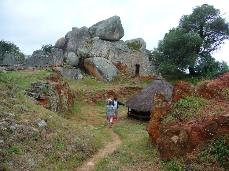
The Great Zimbabwe map provides a detailed representation of the ancient city’s remarkable layout and layout, offering valuable insights into its historical and cultural significance. This map highlights the vast stone structures, enclosures, and key landmarks that showcase the advanced architectural skills of the civilization. Exploring the map helps to visualize the scale and complexity of Great Zimbabwe, making it an essential resource for understanding this iconic archaeological site.
Geographical Location of Great Zimbabwe
The Great Zimbabwe map provides a detailed representation of the ancient stone city located in southeastern Zimbabwe. It illustrates the layout and distribution of various archaeological features, including the walls, enclosures, and surrounding landscape, offering insights into the historical and cultural significance of the site.
- The geographical location of Great Zimbabwe is situated in the hills of southeastern Zimbabwe, approximately 20 kilometers southeast of Masvingo city.
- The site is positioned near the Runde River, which provided strategic advantages and resources for the ancient inhabitants.
- Great Zimbabwe is set within a hilly terrain with granite rocks and is surrounded by fertile land suitable for farming and settlement activities.
- The location lies between latitude 20°30′S and longitude 30°55′E, placing it within the southern part of Africa’s interior highlands.
- The map highlights its proximity to other important archaeological sites and trade routes that facilitated regional interaction and commerce.
Historical Significance of the Map
The Great Zimbabwe Map is a vital historical artifact that provides valuable insights into the ancient city of Great Zimbabwe, one of Africa’s most renowned archaeological sites. It visually represents the layout, key structures, and geographic context of the ancient civilization that thrived between the 11th and 15th centuries. This map serves as an essential tool for both scholars and visitors to understand the scale and sophistication of Great Zimbabwe, which was a major center for trade, politics, and culture in southeastern Africa.
The historical significance of the Great Zimbabwe Map lies in its role in illustrating the extent of the city’s development and the sophistication of its architecture. It highlights the strategic location of the site within trade networks linking the inland regions of Africa with coastal ports, facilitating the exchange of gold, ivory, and other valuable commodities. The map also helps preserve the legacy of the Zimbabwean civilization, showcasing its cultural achievements and its influence on regional history.
- Provides a visual representation of the layout of Great Zimbabwe, including the Great Enclosure, Hill Complex, and valley settlements.
- Offers insights into the urban planning and architectural skills of ancient Zimbabweans.
- Serves as a vital historical record that supports archaeological research and conservation efforts.
- Enhances cultural heritage awareness and national identity for Zimbabweans and Africans more broadly.
- Facilitates educational and tourism activities by offering a clear understanding of the archaeological site’s significance.
Key Features Depicted in the Map
The Great Zimbabwe map provides a detailed visual representation of the ancient city and its surrounding landscape, highlighting its architectural and cultural significance. It offers valuable insights into the geographical layout and historical importance of this UNESCO World Heritage Site.
- Location of the Great Enclosure: The map shows the central area, featuring the largest stone enclosure known for its impressive walling techniques and circular shape.
- Outer walls and stone structures: Key defensive and ceremonial structures, including the multiple concentric walls and corridors, are depicted clearly.
- Terraces and retaining walls: The map highlights the terraced landscape which was used for agriculture and settlement organization.
- Water sources: Rivers, springs, and water catchment features are marked, emphasizing their importance for sustaining the city.
- Entrance routes and pathways: The main access points to the city are illustrated, providing insight into ancient travel and trade routes.
- Surrounding landscape: The map also depicts the broad ecologic zones, such as surrounding hills and plains, which influenced settlement patterns.
- Artifacts and excavations: Specific locations of archaeological finds, such as caves and artifacts, are indicated for research and tourism purposes.
Details of the Map Layout
The layout of the Great Zimbabwe map provides a detailed view of the historic city’s architectural and spatial organization. It highlights the strategic placement of key structures, including the impressive stone enclosures, temples, and communal areas. Understanding the map’s design offers valuable insights into the cultural significance and engineering ingenuity of the ancient civilization that once thrived there.
Layout and Orientation
The map layout of Great Zimbabwe provides a detailed representation of the ancient city’s extensive complex and surrounding areas. It highlights the strategic placement of key features such as the historic walls, enclosures, and the hill complex, illustrating their spatial relationships. The orientation of the map typically aligns with cardinal directions, ensuring accurate representation of geographic orientation, which is essential for understanding the site’s historical and cultural significance. The central focus often includes the Great Enclosure and Valley Ruins, with additional details indicating the locations of modern boundaries, archaeological zones, and natural features like rivers and hills. Overall, the map’s layout emphasizes the grandeur and complexity of Great Zimbabwe, allowing viewers to appreciate its scale and architectural ingenuity while providing contextual spatial awareness of its position within the landscape.
Major Architectural Sites Shown
The map layout of Great Zimbabwe provides a detailed view of the ancient city’s extensive and complex structure. It highlights the key areas, including the main hill, enclosures, and surrounding walls that define the site’s impressive architecture. The layout reveals the strategic placement of the stone walls and towers, which were built without mortar, showcasing advanced stone-working skills. Major architectural sites shown on the map include the Great Enclosure, renowned for its massive circular walls and spacious interior, and the Hill Complex, believed to be the royal residence. Surrounding these core areas are other important sites such as the Valley Ruins and the Outer Wall, demonstrating the city’s vastness and organization. This detailed map layout helps visitors understand the scale and sophistication of Great Zimbabwe’s construction and spatial planning, reflecting the social and political power of its inhabitants.
Territorial Boundaries and Surrounding Areas
The Great Zimbabwe map reveals a sophisticated layout characterized by several key features that highlight its historical and architectural significance. Central to the map are the extensive stone enclosures, including the Great Enclosure, which is one of the largest ancient structures in sub-Saharan Africa. These structures are crafted with precisely fitted granite stones, showcasing advanced construction techniques of the time. The map also indicates the presence of surrounding walls, courtyards, and smaller courtyard complexes that form a complex urban plan. The territorial boundaries are traditionally defined by natural features such as valleys, hills, and defensive walls that demarcate the core area of the ancient city from the surrounding landscape.
The territorial boundaries of Great Zimbabwe extend to encompass a large area that includes both the central stone enclosures and the surrounding regions that supported the city’s economy and social organization. The map shows the extent of the city’s perimeter walls, which once protected the inner city from invaders and marked the sacred space of the site. Surrounding areas include archeological sites of lesser masonry and burial sites, indicating a broader territorial domain used for specific purposes. Natural features like rivers, mountains, and plains are also depicted, illustrating how geography influenced the development and defense of Great Zimbabwe. These surrounding areas played a vital role in trade, agriculture, and resource management, contributing to the prominence of the city in ancient times.
Elements Depicted in the Map
The map of Great Zimbabwe showcases the remarkable archaeological site and its surrounding landscape, highlighting the key elements that define its historical significance. It provides a visual representation of the ancient city’s layout, including stone enclosures, residential areas, and zones of ceremonial importance. By examining the elements depicted in the map, visitors can gain a deeper understanding of the scale, organization, and cultural heritage of this UNESCO World Heritage Site.
Stone Enclosures and Structures
The Great Zimbabwe map illustrates a variety of elements that highlight the archaeological and architectural significance of the site. Prominent among these are the stone enclosures and structures that showcase the ancient civilization’s ingenuity and craftsmanship. Large, meticulously built stone walls and towers form the core of the site, reflecting advanced stoneworking skills. These structures include the Main Enclosure, known for its impressive semicircular wall, and the Hill Complex, which features private and ceremonial spaces. The map also depicts smaller enclosures, terraces, ritual areas, and pathways connecting different parts of Great Zimbabwe, illustrating the complex social and political organization of the historical settlement. Overall, the depicted elements demonstrate the magnificence and cultural richness of this ancient capital of the Kingdom of Zimbabwe.
Landmarks and Prominent Features
The Great Zimbabwe map illustrates a variety of important elements, landmarks, and prominent features that reflect the ancient city’s historical significance. Central to the map are the large stone enclosures, including the Great Enclosure, which is one of the most recognizable symbols of Zimbabwe’s archaeological heritage. Surrounding these structures are remnants of ancient walls and terraces that showcase sophisticated stonework and urban planning. The map also highlights the location of the Hill Complex, an elevated area that provided strategic advantage and served as a royal or religious center. Nearby, the map marks key features such as the various tombs, moats, and pathways that once facilitated movement and ceremonial activities. Landmarks like the principal gateways and quarters also stand out, representing the social and political organization of the ancient civilization. Overall, the map vividly depicts the grandeur and complexity of Great Zimbabwe’s architecture and strategic layout, emphasizing its role as a significant cultural and historical site in southern Africa.
Natural Elements and Topography
The Great Zimbabwe map highlights a variety of elements that showcase the region’s rich natural landscape and topographical features. Natural elements such as rivers, mountains, and surrounding vegetation play a significant role in shaping the area’s geography. The terrain includes rolling hills and elevated plateaus, which have historically influenced settlement patterns and the construction of the ancient city. Water bodies like the Runde and Save rivers are also depicted, illustrating their importance to the civilization’s agriculture and daily life. Overall, the map provides a detailed view of the natural environment that has contributed to the cultural and archaeological significance of Great Zimbabwe.
Historical Insights from the Map
The Great Zimbabwe map offers a fascinating window into the rich history and cultural significance of one of Africa’s most ancient and iconic archaeological sites. By examining the map, we can gain valuable insights into the ancient city’s layout, territorial extent, and the historical context in which it thrived. These visual representations help unravel the mysteries of its architecture, trade routes, and the civilization that once flourished there, enhancing our understanding of this remarkable heritage.
Archaeological Significance
The Great Zimbabwe map offers valuable historical insights into the ancient civilization that thrived in southeastern Africa. It reveals the extent of the complex city, highlighting the advanced architectural skills and social organization of its inhabitants. The map provides clues about trade routes, resource distribution, and cultural interactions with neighboring regions, underscoring the site’s importance in regional history.
From an archaeological perspective, the map assists researchers in identifying key areas of the site for excavation and preservation. It helps in understanding the layout of the city, including the locations of major structures and ceremonial sites. This geographical representation enriches the study of how Great Zimbabwe functioned socially and economically, providing a tangible link to its historical and cultural significance. Overall, the map is an essential tool that enhances our appreciation of the archaeological richness and historical depth of this ancient city.
Trade Routes and Connectivity
The map of Great Zimbabwe reveals significant historical insights into the region’s ancient trade networks and connectivity. It highlights the strategic placement of the city within trade routes that linked inland communities with distant coastal ports, facilitating the exchange of goods, culture, and ideas. Analyzing these routes provides a glimpse into the economic and social organization of the society that built and inhabited Great Zimbabwe.
- Trade routes connected Great Zimbabwe with the Swahili Coast, enabling the export of gold, ivory, and other local resources.
- Connectivity with neighboring regions fostered cultural exchanges, evident in the diverse artifacts found at the site.
- The map indicates the presence of well-established pathways that suggest a highly organized infrastructure for transportation and communication.
- Trade routes may have contributed to the development of urban centers and the political stability of the kingdom.
- By studying the map, historians can infer the extent of Great Zimbabwe’s influence and its role within regional trade networks.
Cultural Influences Displayed
The Great Zimbabwe map offers valuable historical insights into the ancient civilization that once thrived in southeastern Africa. It reveals the extensive layout of the city, illustrating the advanced architectural skills and societal organization of the Shona people. The map highlights the strategic placement of stone structures, which reflect the region’s historical importance as a center of trade and political power. Additionally, the distribution of ruins and territories on the map underscores the influence of indigenous cultures and their integration with trade routes connecting Africa with Asia and the Middle East.
Culturally, the map displays the profound ingenuity and artistic expression inherent in Great Zimbabwe. The intricate stonework and construction techniques demonstrate a sophisticated understanding of engineering and aesthetics. Symbols and layout patterns mapped out identify cultural practices, social hierarchies, and spiritual beliefs deeply rooted in the local traditions. The map also showcases how trade and cultural exchanges contributed to the development of unique art forms and symbolic representations, emphasizing the cultural diversity and richness of the society that built Great Zimbabwe.
Modern Interpretations of the Map
The Great Zimbabwe map offers a fascinating glimpse into how modern interpretations continue to shape our understanding of this ancient site. Through advanced technology and scholarly analysis, contemporary perspectives reveal new insights into the historical and cultural significance of the Great Zimbabwe empire. These interpretations help to reconnect people with their heritage while enhancing the academic study of this iconic monument.
Replicas and Digital Models
The modern interpretations of the Great Zimbabwe map, replicas, and digital models offer a fascinating glimpse into how contemporary technology enhances our understanding and appreciation of this ancient site. Through advanced digital reconstructions, researchers can visualize the original layout, scale, and intricate design of Great Zimbabwe, providing insights that were previously difficult to attain. Replicas, both physical and virtual, serve as educational tools that bring the history and cultural significance of the monument to a broader audience. These modern interpretations not only aid scholars in studying the architecture and societal organization of the ancient inhabitants but also promote preservation efforts by documenting the site in detail. As digital models become more sophisticated, they enable interactive experiences, allowing users to explore the complex stone structures remotely, fostering a deeper connection with this UNESCO World Heritage site. Overall, the integration of digital technology and replica creation enriches the ongoing dialogue about Great Zimbabwe’s historical and archaeological importance, ensuring its legacy endures for future generations.
Use in Educational Contexts
The Great Zimbabwe map serves as a vital educational tool that facilitates a deeper understanding of the historical and cultural significance of Great Zimbabwe. Modern interpretations of this map emphasize its role in illustrating the geographic layout, architectural features, and spatial relationships within the ancient city, enabling students to visualize and contextualize archaeological findings effectively. In educational contexts, maps of Great Zimbabwe are used to explore themes such as trade networks, societal organization, and regional influence, fostering critical thinking and engagement with African history. Additionally, digital and interactive maps have enhanced learning experiences by providing dynamic, accessible, and detailed representations that support interdisciplinary studies, including archaeology, history, and geography.
Conservation and Preservation Efforts
The interpretation of the Great Zimbabwe map has evolved significantly, reflecting contemporary perspectives on historical site preservation and cultural heritage. Modern approaches emphasize understanding the map not only as a geographical tool but also as a means to explore the cultural, social, and political significance of Great Zimbabwe. Scholars and conservationists focus on integrating traditional knowledge with scientific methods to gain a comprehensive view of the site’s historical context.
Conservation efforts today prioritize sustainable practices that balance the need to protect the ancient structures with promoting tourism and local community involvement. Preservation initiatives include careful restoration techniques, archaeological research, and the implementation of protective measures to prevent deterioration caused by environmental factors and human activity. These efforts aim to ensure that future generations can appreciate the cultural legacy represented by the Great Zimbabwe map and site.
In addition, modern interpretations challenge earlier colonial narratives and encourage indigenous communities to take an active role in managing and interpreting their heritage. This shift fosters a more inclusive understanding of the Great Zimbabwe map as a symbol of cultural identity and historical pride, aligning conservation efforts with cultural empowerment and educational initiatives that highlight the site’s significance within African history.


0 Comments