.jpeg")
Overview of Addis Ababa
Addis Ababa, the bustling capital city of Ethiopia, serves as the political, cultural, and economic hub of the country. Known for its vibrant markets, historic sites, and diverse population, the city offers a unique blend of tradition and modernity. Exploring Addis Ababa through a detailed map provides valuable insights into its layout, key landmarks, and infrastructure, making it an essential resource for visitors and residents alike.
Geographical Location
Addis Ababa, the capital city of Ethiopia, is situated in the central part of the country on a high plateau. It serves as the political, economic, and cultural center of Ethiopia, hosting many government offices, international organizations, and historical sites. The city is known for its diverse topography, including hills, valleys, and rivers that contribute to its unique landscape.
- Located at an altitude of approximately 2,355 meters (7,726 feet) above sea level
- Situated in the Oromia Region, but officially recognized as a separate administrative entity
- Positioned roughly in the center of Ethiopia, making it an ideal hub for transportation and communication
- Bounded by the Entoto Mountains to the north and the great Rift Valley to the southeast
Districts and Neighborhoods
Addis Ababa, the capital city of Ethiopia, is a vibrant metropolis known for its rich history, diverse culture, and rapid development. The city is divided into various districts and neighborhoods, each offering unique attributes and local flavors. These districts are well organized to facilitate administrative functions, urban planning, and community life.
Among the prominent districts are Bole, known for its bustling commercial activities and international hotels; Gullele, recognized for its parks and residential areas; and Kirkos, which is a central hub with markets and government offices. Other notable districts include Yeka, known for its greenery and upscale residences; and Nifas Silk Lafto, an important transit and industrial zone.
Within these districts, neighborhoods such as Azeb, Banca, and Saris all contribute to the diverse urban landscape of Addis Ababa. Each neighborhood features a mix of traditional and modern architecture, local markets, cafes, and cultural sites that reflect the city’s evolving identity. The comprehensive Addis Ababa map highlights these districts and neighborhoods, offering a detailed view of the city’s layout and facilitating navigation and urban planning.
Administrative Boundaries
Addis Ababa, the capital city of Ethiopia, is a vibrant metropolitan area with a rich history and diverse cultural landscape. It serves as the political, economic, and cultural hub of the country. The city is organized into various administrative boundaries, including several sub-cities and districts, which help manage its rapid growth and urban development. These boundaries are delineated to facilitate local governance, planning, and service delivery across the city.
Map Features and Landmarks
Discovering Addis Ababa, Ethiopia, through its map features and landmarks offers a fascinating glimpse into the city’s rich history and vibrant culture. From iconic monuments to bustling neighborhoods, the map highlights key locations that define the city’s identity. Understanding these features can enhance your navigation experience and deepen your appreciation of Addis Ababa’s unique urban landscape.
Main Roads and Streets
In the Addis Ababa map, various features and landmarks help users navigate the city effectively. Prominent locations such as the National Museum, Holy Trinity Cathedral, and Addis Ababa University are clearly marked, serving as important landmarks for residents and visitors alike. Main roads like Africa Avenue, Bole Road, and the ring roads connect different parts of the city, facilitating smooth transportation. Streets within neighborhoods are detailed to enable precise navigation, with key intersections and bus stops indicated for convenience. The map’s design highlights essential features, making it a useful tool for exploring Addis Ababa efficiently.
Public Buildings and Institutions
Addis Ababa, the capital city of Ethiopia, features a variety of prominent landmarks and notable public buildings that help shape its unique urban landscape. The city is home to important government institutions, such as the Ethiopian Parliament and the Office of the Prime Minister, which are situated in key areas of the city.
Among the significant landmarks are the Holy Trinity Cathedral, an iconic religious site, and the National Museum of Ethiopia, which houses important artifacts and the famous Lucy skeleton. other landmarks include Unity Park, a major recreational and cultural space, and the Meskel Square, a central hub often used for public gatherings and celebrations.
Public buildings like the Addis Ababa University and the African Union headquarters also contribute to the city’s status as a center for educational and international diplomacy. The city’s map showcases these landmarks and institutions, offering a visual understanding of Addis Ababa’s cultural, political, and educational hubs, making it an essential guide for residents and visitors alike.
Historical Sites and Monuments
Discovering Addis Ababa on the map reveals a city rich in diverse features, landmarks, historical sites, and monuments that reflect Ethiopia’s vibrant history and culture.
- Holy Trinity Cathedral: An important religious site and a stunning example of Ethiopian Orthodox architecture.
- National Museum of Ethiopia: Home to the famous Lucy skeleton and numerous artifacts showcasing Ethiopia’s ancient history.
- Mount Entoto: Offering panoramic views of Addis Ababa and housing historic churches and palaces.
- Jamesbeno Monument: Commemorating Ethiopia’s victory during the Battle of Adwa and national heroes.
- St. George’s Cathedral: A significant religious monument and a symbol of Ethiopian Christianity.
- Merkato: One of Africa’s largest open-air markets, combining cultural activity with historical significance.
- African Union Headquarters: An important political landmark representing the continent’s unity and cooperation.
Exploring these features and landmarks on the Addis Ababa map offers insights into Ethiopia’s illustrious past and vibrant present, making it a city worth learning about and visiting.
Topographical and Natural Features
Addis Ababa, the vibrant capital of Ethiopia, is characterized by diverse topographical and natural features that shape its unique landscape. From rolling hills and highlands to lush green areas, the city’s geographical makeup plays a crucial role in its climate, urban development, and cultural identity. Exploring these natural features provides a deeper understanding of Addis Ababa’s physical environment and its importance within the Ethiopian highlands.
Elevation and Terrain
Addis Ababa, the capital city of Ethiopia, is characterized by its diverse topographical and natural features. The city is situated on a high plateau at an elevation of approximately 2,355 meters (7,726 feet) above sea level, making it one of the highest capitals in the world. The terrain surrounding Addis Ababa is predominantly hilly and mountainous, with a series of ridges and valleys that influence local climate and drainage patterns. The region features several peaks and elevated areas, providing scenic views and affecting urban development. Natural features such as lush greenery, parks, and small water bodies are integrated into the city’s landscape, contributing to its scenic beauty and environmental significance. The elevation and varied terrain play a crucial role in shaping the climate, agriculture, and settlement patterns within and around Addis Ababa. Overall, the city’s topography offers a unique blend of natural and geographical characteristics that define its physical identity on the Ethiopia map.
Water Bodies and Green Spaces
Addis Ababa, the capital city of Ethiopia, is characterized by its diverse topography and natural features. The city is situated on a high plateau at an elevation of approximately 2,355 meters above sea level, offering stunning views of surrounding mountains and valleys. The landscape includes rolling hills, ridges, and deep gullies that contribute to its unique topography.
Several water bodies flow through and around Addis Ababa, including rivers, streams, and smaller lakes. The Awash River and its tributaries play an essential role in the region’s water system, providing water resources for the city. Additionally, the city features numerous natural springs and small water bodies that support local ecosystems and contribute to urban greenery.
Green spaces are an integral part of Addis Ababa, with numerous parks, botanical gardens, and tree-lined avenues. Entoto Hills and Mount Bole are prominent natural features offering recreational activities and panoramic views. The city’s commitment to maintaining green spaces is evident in parks like Meskel Square and Addis Ababa University Botanical Garden, which provide residents and visitors with natural retreats amid urban life.
Transportation Network
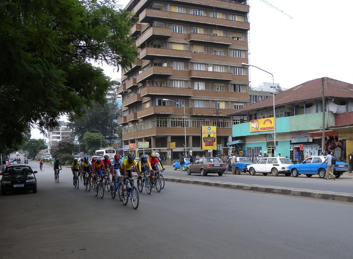
Transportation networks in Addis Ababa, Ethiopia, play a crucial role in connecting residents, visitors, and goods across the city. As the capital and largest city of Ethiopia, Addis Ababa features a rapidly developing transportation system that includes buses, minivans, and road infrastructure. These networks facilitate daily commuting and are vital for the city’s economic growth and urban development. Exploring the map of Addis Ababa helps in understanding the strategic placement of routes and key transportation hubs that serve the city’s vibrant community.
Public Transit Routes
The transportation network and public transit routes in Addis Ababa, Ethiopia, play a vital role in connecting residents and visitors across the city. The city’s comprehensive bus system, operated by the Addis Ababa Transit Service, covers major neighborhoods, commercial areas, and suburbs, ensuring efficient mobility. Additionally, the light rail transit (LRT) system, inaugurated in recent years, provides a modern and reliable mode of transportation, reducing congestion and travel time. The city continues to expand its transit infrastructure, aiming to improve accessibility and sustainability for its growing population. An Addis Ababa map showcases these routes, helping users navigate the city’s transportation options effectively. These routes are designed to facilitate easy movement within the urban area and support economic activities, making public transit a crucial component of Addis Ababa’s development.
Major Intersections and Traffic Flow
The transportation network in Addis Ababa, Ethiopia, is vital for facilitating movement within the city and connecting it to surrounding regions. Major intersections serve as key hubs that enable smooth traffic flow and accessibility across different parts of the city, reducing congestion and improving overall transportation efficiency. Understanding the layout of these intersections and traffic patterns is essential for urban planning and development in the area.
- The Addis Ababa map highlights prominent roads such as Africa Avenue, Bole Road, and Ring Road, which are critical arteries in the city’s transportation network.
- Major intersections, including the Mexico Square, Meskel Square, and the intersection near the African Union Headquarters, act as focal points for traffic coordination and distribution.
- Traffic flow varies throughout the day, with peak hours typically occurring in the morning and late afternoon, leading to increased congestion at key nodes.
- Efforts to improve transportation include the expansion of roads, implementation of traffic management systems, and the development of new transit routes like the Addis Ababa Light Rail.
- Mapping these transportation features assists travelers and planners in understanding traffic movements and optimizing route choices within the city.
Urban Development and Planning
Urban development and planning are essential processes that shape the growth and organization of cities, ensuring they are sustainable, functional, and livable. In rapidly expanding urban areas like Addis Ababa, Ethiopia, effective planning is crucial to accommodate population growth, improve infrastructure, and enhance the overall quality of life for residents. Analyzing maps of such cities provides valuable insights into their development patterns and future growth prospects.
City Expansion Zones
Urban development and planning play a crucial role in shaping the growth of Addis Ababa, Ethiopia’s capital. As the city expands rapidly, establishing designated City Expansion Zones helps manage growth sustainably and efficiently. These zones are planned areas intended to accommodate future population increase, infrastructure development, and economic activities, ensuring organized urban growth.
- Contiguous expansion zones are often identified around the city to prevent sprawl and maintain connectivity.
- Designated zones include mixed-use developments, residential neighborhoods, commercial centers, and green spaces.
- Proper planning of expansion zones aims to improve transportation networks, reduce congestion, and enhance the quality of life.
- Implementation of land use policies within these zones supports balanced growth and resource management.
- Mapping these zones on the Addis Ababa map helps urban planners, stakeholders, and residents understand future development directions.
- Identify existing city boundaries and infrastructure to determine logical expansion areas.
- Involve community participation to ensure zones meet local needs and preferences.
- Incorporate sustainable practices, including eco-friendly urban designs and renewable energy use.
- Establish enforcement mechanisms to regulate development within designated zones.
- Maintain regularly updated maps to reflect ongoing development and policy changes.
Construction Projects
The city of Addis Ababa, Ethiopia, has experienced significant urban development and planning initiatives aimed at transforming it into a modern metropolis. These efforts include sustainable construction projects, infrastructure upgrades, and urban renewal programs designed to accommodate its growing population. Strategic planning ensures that development aligns with environmental considerations and social needs, promoting a balanced and inclusive cityscape.
Construction projects in Addis Ababa focus on expanding transportation networks, including road expansion and the development of new public transit systems to improve mobility. Upcoming residential, commercial, and mixed-use developments aim to support economic growth while maintaining urban aesthetics and functional spaces. Mapping these projects provides valuable insights into the city’s development trajectory and future urban landscape.
Using the Map
The map of Addis Ababa, Ethiopia, provides a valuable visual tool for navigating and understanding the city’s layout. It helps residents, visitors, and urban planners to easily locate key areas, streets, and landmarks within the capital. Exploring the map enhances familiarity with the city’s geography, making travel and navigation more efficient and enjoyable.
Navigation Tips
When using the map of Addis Ababa, Ethiopia for navigation, it is essential to familiarize yourself with key landmarks and main streets to orient yourself effectively. Always start by identifying your current location on the map to plan the most efficient route to your destination. Make sure to use clear and well-marked roads, and pay attention to major intersections, especially when navigating through busy areas of the city. Utilizing digital maps with GPS capabilities can enhance accuracy and provide real-time directions, which are particularly helpful in Addis Ababa’s dynamic traffic conditions. Additionally, keep a physical map handy as a backup in case of technology failure, ensuring you can still navigate confidently through the city.
Online and Printed Map Resources
Using maps, whether online or printed, is essential for navigating and exploring Addis Ababa, Ethiopia. Online maps offer real-time updates, detailed directions, and interactive features that enhance the user experience. Popular platforms like Google Maps and Bing Maps provide comprehensive views of the city, including street layouts, landmarks, and transportation routes. Printed maps, on the other hand, serve as reliable resources in areas with limited internet access or for those who prefer a tangible reference. They often highlight key neighborhoods, tourist attractions, and important facilities, making them useful for planning trips or understanding the city’s geography. Combining both online and printed map resources can give travelers and residents a more complete and adaptable way to navigate Addis Ababa effectively.


0 Comments