.jpeg")
Historical Significance of Ancient Egyptian Maps
Ancient Egyptian maps hold a remarkable place in history, reflecting one of the earliest efforts to document and understand the world around them. These maps reveal insights into the civilization’s geographical knowledge, trade routes, and cultural priorities. by studying these early cartographic representations, modern historians gain a deeper appreciation of how ancient Egyptians navigated and conceptualized their environment, highlighting their ingenuity and the significance of spatial awareness in their society.
Purpose and Uses of Maps in Ancient Egypt
Ancient Egyptian maps hold a significant place in history as they reveal the advanced understanding and organization of space in one of the world’s earliest civilizations. These maps, though not as geographically precise as modern ones, served vital purposes in the social, religious, and administrative contexts of ancient Egypt. They often depicted important landmarks, trade routes, and territorial boundaries, reflecting the importance of maintaining control over the Nile Delta and surrounding regions. Maps also played a role in religious practices, illustrating sacred landscapes and ensuring the alignment of temples and tombs with celestial and earthly features.
The primary purpose of maps in ancient Egypt was to facilitate administrative and logistical activities such as land division, resource management, and navigation. During the era of organized statehood, these maps helped officials oversee agricultural production, allocate land parcels, and manage irrigation systems, crucial for sustaining Egypt’s prosperity. Additionally, maps were used in planning military campaigns and establishing territorial claims, ensuring control over strategic areas. They also served a ceremonial role, aiding in the construction of monumental architecture and helping priests and scribes to visualize sacred sites and cosmological concepts.
Types of Maps Used in Ancient Egypt
Ancient Egyptian maps hold a significant place in the history of cartography as they reflect the early efforts of the civilization to understand and represent their world. These maps provide valuable insights into how the Egyptians viewed their environment, navigated their landscapes, and documented important locations such as cities, temples, and trade routes. Their use of maps also demonstrates the importance of spatial awareness in their society, especially for purposes related to navigation, administration, and religious practices.
Several types of maps were used in ancient Egypt, including pictorial maps, navigational charts, and administrative plans. Pictorial maps often depicted the landscape with stylized symbols and hieroglyphs, illustrating regions of significance such as the Nile River, delta, and surrounding deserts. Navigational charts, though less detailed than modern maps, helped travelers and traders traverse waterways and desert routes. Administrative maps, created for official purposes, detailed land holdings, taxation areas, and boundaries essential for governance and resource management. These different map types reveal the advanced level of spatial representation achieved by the ancient Egyptians and their importance in the development of early cartography.”
Materials and Techniques for Map Creation
Ancient Egyptian maps hold significant historical value as they offer insights into the civilization’s understanding of their world, territory, and environment. These maps often served practical purposes such as land division, navigation, and religious or ceremonial functions. Their existence reflects the Egyptians’ advanced knowledge of geography and their ability to document spatial information in a structured manner, which contributed to their administrative and military efficiency.
The materials used for creating these maps were primarily papyrus, clay tablets, and stones. Papyrus was the most common medium, allowing for relatively flexible and portable documents, often inscribed with ink made from natural pigments. Clay tablets, inscribed with cuneiform-like characters, provided durable surfaces for geographic and administrative records. In some cases, carved or painted stones were used for more permanent markings, especially in monumental contexts.
The techniques for map creation involved careful drawing, often using brushes, reed pens, or chisels, depending on the medium. Ink was typically made from soot, charcoal, or minerals mixed with water or other binding agents. Artists and scribes employed a symbolic and highly stylized visual language, with conventions that distinguished roads, water bodies, settlements, and sacred sites. The precision and artistry evident in ancient Egyptian maps demonstrate their sophisticated approach to spatial representation, combining utility with cultural and religious symbolism.
Geographical Features Depicted in Ancient Egyptian Maps
Ancient Egyptian maps offer a fascinating glimpse into how early civilizations understood and represented their world. These maps typically illustrate various geographical features such as the Nile River, surrounding desert landscapes, and important cities or regions. Through these depictions, we can gain insights into the priorities and knowledge of ancient Egyptians as they navigated and organized their environment. Examining these geographical features helps us appreciate the skills and perspectives of one of the world’s earliest mapping cultures.
Nile River and Its Courses
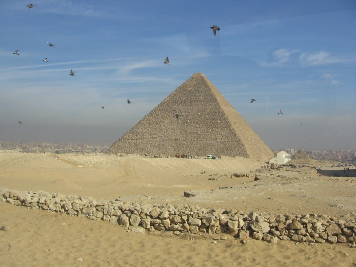
Ancient Egyptian maps often depicted key geographical features that were central to their understanding of the world around them. One of the most prominent features shown in these maps is the Nile River, which was essential for the civilization’s agriculture, transportation, and sustenance. The Nile’s course was typically depicted as a vital lifeline flowing from south to north, illustrating its significance in connecting Upper and Lower Egypt. The maps usually highlighted the river’s various branches, delta region, and surrounding landscapes, emphasizing the importance of the Nile’s fertile banks. In addition to the Nile itself, ancient Egyptian maps often included representations of nearby mountains, desert boundaries, and oases, which helped travelers and officials orient themselves within this landscape. The detailed portrayal of these geographical features underscores the central role that the Nile and its courses played in shaping ancient Egyptian society and geography.
Desert Landscapes and Oases
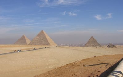
Ancient Egyptian maps primarily showcased their understanding of the surrounding landscape, emphasizing key geographical features such as desert landscapes and oases. These maps often depicted expansive desert terrains with detailed illustrations of shifting sand dunes, rocky outcrops, and treacherous terrains that travelers had to navigate. Oases were prominently marked as vital focal points, serving as essential sources of water and sustenance in the arid environment. These green patches amidst the desert were often highlighted to guide traders and travelers through the vast emptiness. Although the maps did not always adhere to modern cartographic accuracy, they reflected the Egyptians’ deep familiarity with their environment, illustrating the importance of water sources and natural landmarks in their navigation and survival strategies. The visual representation of deserts and oases underscores their critical role in ancient Egyptian life, trade routes, and cultural development, offering insights into how they perceived and interacted with their landscape.
Urban and Sacred Sites
Ancient Egyptian maps provide valuable insights into the geographical features, urban settlements, and sacred sites that held significance in their civilization. These maps often depicted important rivers such as the Nile, which was the lifeblood of Egypt, illustrating its course, delta regions, and surrounding desert landscapes. The Nile’s annual flooding was crucial for agriculture, and its depiction in maps highlights its prominence in Egyptian life. Urban centers like Thebes, Memphis, and Heliopolis are frequently marked, showcasing their roles as political, religious, and commercial hubs. Sacred sites such as temples, tombs, and pilgrimage locations are also prominently featured, emphasizing the spiritual importance of certain geographic locations. These maps also often illustrate natural features like mountains, deserts, and oases, providing a comprehensive view of Egypt’s diverse landscape as understood by ancient cartographers. Overall, the maps serve as a testament to the Egyptians’ keen observation of their environment and their desire to represent not just physical geography but also the spiritual landscape that defined their civilization.
Notable Ancient Egyptian Maps and Their Discoveries
Ancient Egyptian maps offer a fascinating glimpse into the world as it was understood thousands of years ago. These remarkable cartographic artifacts reveal how early Egyptians viewed their landscape, navigated their environment, and recorded important geographical information. Through these maps, scholars have uncovered lost cities, trade routes, and significant landmarks that shed light on Egypt’s rich historical and cultural heritage.
The Turin Papyrus Map
The Turin Papyrus Map is one of the most remarkable and significant ancient Egyptian maps, offering valuable insights into early cartography and resource exploration. Discovered in Egypt, this papyrus scroll dates back to around 1150 BCE and provides a rare glimpse into how ancient Egyptians depicted their environment and mining activities. The map primarily focuses on mineral deposits, particularly gold, and illustrates the geographic layout of mineral-rich regions, including detailed representations of the desert landscape and mountain ranges. Its detailed annotations and symbols reveal that the Egyptians possessed advanced knowledge of their terrain and had developed sophisticated methods for documenting natural resources. The Turin Papyrus Map is considered a crucial artifact that enhances understanding of ancient Egyptian economic activities, exploration practices, and their approach to geographical representation, solidifying its status as a notable achievement in ancient cartography.
The Shebyu Map from Wadi Hammamat
The Shebyu Map from Wadi Hammamat is one of the most notable ancient Egyptian maps, providing valuable insights into early cartographic practices and exploration in the region. Discovered in the Wadi Hammamat quarry area, this map dates back to the Middle Kingdom period, around 2000 BCE. It depicts a detailed representation of the local landscape, including mountains, routes, and important landmarks, showcasing the Egyptians’ advanced understanding of their environment. The map served both practical purposes, such as guiding mining expeditions and territorial navigation, and symbolic roles related to religious and cultural beliefs. Its discovery has significantly contributed to our knowledge of ancient Egyptian geography, land use, and their methods of recording spatial information. The Shebyu Map stands as a testament to the early development of cartography in Egypt and highlights the sophistication of their craft in documenting the world around them.
Other Notable Cartographic Artifacts
Ancient Egyptian maps and cartographic artifacts offer fascinating insights into the civilization’s understanding of their world and beyond. These artifacts, often intertwined with religious and practical purposes, reveal the sophistication of early mapmaking and geographical knowledge in ancient Egypt. Recent discoveries have shed light on how Egyptians viewed their surroundings and their place within a larger universe, combining religious symbolism with practical navigation tools.
Notable ancient Egyptian maps and cartographic artifacts include the following:
- The Turin Papyrus Map: Considered one of the oldest known topographical maps, it depicts mineral deposits and terrain features in the Eastern Desert, dating back to around 1150 BCE. Its detailed illustrations help archaeologists understand mining expeditions and resource extraction practices of ancient Egypt.
- The Saqqara Map: A fragmentary map inscribed on a papyrus which is believed to show the layout of a burial complex at Saqqara. It provides insights into Egyptian funerary architecture and spatial organization.
- The Map of the Nile: Several ancient inscriptions and diagrams depict the course of the Nile River, illustrating its importance for transportation, agriculture, and religious symbolism in Egyptian society.
- The Kitab al-Istiqsa (Book of Geographic Descriptions): A later Islamic-era compilation based on ancient Egyptian and Greek sources, containing descriptions and maps of Egypt that highlight the continuity of geographical knowledge over centuries.
Aside from explicit maps, other notable cartographic artifacts include religious and mythological diagrams such as star charts and funerary texts like the “Book of the Dead,” which contain celestial representations and cosmological maps. These artifacts reflect the Egyptians’ intricate relationship with geography, astronomy, and spirituality, highlighting their advanced understanding of the cosmos and Earth’s features. The ongoing study of these artifacts continues to deepen our appreciation of ancient Egyptian cartography and their contribution to early geographical sciences.
Symbolism and Artistic Elements in Egyptian Maps
Ancient Egyptian maps are fascinating examples of early cartographic efforts that blend practicality with rich symbolism. They often feature artistic elements that reflect the cultural and religious beliefs of the time, using symbols to represent geographical features, deities, and divine concepts. Understanding these artistic and symbolic elements provides deeper insight into how the Egyptians viewed their world and their place within the cosmos.
Iconography and Artistic Style
Ancient Egyptian maps are rich in symbolism and artistic elements that reveal their worldview, religious beliefs, and hierarchical structure. These maps often depict sacred landscapes, routes, and territories with carefully stylized symbols that reflect their divine significance. The use of vibrant colors, geometric patterns, and detailed iconography exemplifies their artistic mastery and spiritual emphasis. Figures such as gods, pharaohs, and mythological creatures are integrated into maps to convey divine protection and authority, blending practical geography with religious symbolism. Artistic style in these maps is characterized by a two-dimensional, hierarchical layout where important figures and locations are emphasized through size and prominence, highlighting their spiritual and political importance. Overall, Egyptian maps serve as both navigational tools and visual expressions of their complex religious and cultural worldview, with symbolism and artistic elements playing a central role in their design and interpretation.
Use of Hieroglyphs and Symbols
Ancient Egyptian maps are rich in symbolism and artistic elements that reflect their cultural and spiritual worldview. These maps often incorporated detailed hieroglyphs and symbols, serving both practical and religious purposes. Hieroglyphs, the writing system of ancient Egypt, were used to label landmarks, depict routes, and convey divine or protective symbolism, making the maps not only navigational tools but also spiritual guides. The artistic elements in these maps, such as stylized illustrations of rivers, mountains, and settlements, often emphasized their importance through ornate designs and vivid imagery, blending functionality with sacred symbolism. Colors, borders, and decorative motifs further enhanced the maps’ aesthetic appeal while underlying messages about order, harmony, and the divine nature of the land. Overall, the integration of hieroglyphs and symbolic artistry in Egyptian maps underscores their role as both practical documents and expressions of spiritual belief systems.”
Representation of Sacred and Mythological Elements
Ancient Egyptian maps serve as fascinating artifacts that combine practical navigation with rich symbolism and artistic expression. These maps often incorporate sacred and mythological elements that reflect the Egyptians’ deeply spiritual worldview, emphasizing the divine nature of their environment and the cosmos. Symbols such as gods, sacred animals, and hieroglyphic motifs are seamlessly integrated into the cartographic representations, conveying not only geographic information but also spiritual significance. Artistic elements like detailed illustrations, vibrant colors, and stylized forms elevate these maps from mere navigational tools to works of religious and cultural expression, illustrating the Egyptians’ belief in the interconnectedness of the earthly and divine realms. Overall, Egyptian maps exemplify a unique blend of functional mapping and sacred symbolism, revealing a worldview where territory and spirituality are inseparably linked.
Impact and Legacy of Ancient Egyptian Cartography
Ancient Egyptian cartography holds a significant place in the history of geographic knowledge, reflecting the civilization’s advanced understanding of their world and beyond. These early maps not only served practical purposes such as navigation and land division but also embodied the cultural and religious beliefs of the time. The impact of Egyptian contributions to cartography laid foundational principles that influenced later mapmaking traditions, leaving a lasting legacy in the development of spatial representation and geographical awareness.
Influence on Later Civilizations
Ancient Egyptian cartography laid a foundational role in the development of geographical understanding in the ancient world. Their maps, often created for practical purposes such as land division, navigation, and religious rituals, demonstrated a sophisticated knowledge of their environment and contributed to the dissemination of spatial awareness across neighboring civilizations.
The impact of Egyptian maps extended beyond their own culture, influencing later civilizations such as the Greeks and Romans. Through interactions and trade, ideas about map-making, including the use of symbolic representations and the concept of documenting landmarks and territories, were transmitted and refined. The Egyptians’ emphasis on map accuracy and the integration of religious and practical elements set a precedent for subsequent geographic documentation.
Legacy of ancient Egyptian cartography can be seen in the evolution of map-making techniques, including the development of more detailed and standardized representations of space. Their contributions helped shape the conceptual and methodological frameworks that later civilizations built upon, ultimately advancing the global history of geography and navigation. The enduring influence of Egyptian maps signifies their importance in the progression from mythological and religious representations to scientific and empirical approaches in cartography.
Preservation and Archaeological Discoveries
Ancient Egyptian cartography played a crucial role in shaping the understanding of their world, serving both practical and symbolic purposes. Maps and geographic records helped organize trade routes, land boundaries, and resource locations, reflecting the civilization’s advanced knowledge of their environment. The legacy of these early maps demonstrates the Egyptians’ sophisticated approach to spatial awareness and their emphasis on cosmic and divine order.
The preservation of Egyptian documents, including papyri containing geographical references and maps, has significantly contributed to our understanding of ancient perceptions of space. These artifacts provide insight into how Egyptians viewed their land, religious geography, and celestial phenomena, offering a window into their worldview and administrative practices.
Archaeological discoveries have unearthed invaluable maps and related artifacts, such as wall carvings, inscriptions, and preserved scrolls. Excavations at sites like Amarna and Deir el-Medina have revealed detailed depictions of territories, routes, and city layouts, enriching modern knowledge of Egyptian spatial organization. These findings not only illuminate ancient mapping techniques but also demonstrate the importance of geography in Egyptian culture and governance, leaving a lasting impact on the history of cartography and archaeological research.
Modern Interpretations and Reassessments
The impact and legacy of ancient Egyptian cartography are profound, reflecting one of the earliest known attempts to depict and understand the world around them. These maps served not only practical purposes such as navigation, land division, and resource management but also held religious and symbolic significance, illustrating the Egyptians’ worldview and relationship with the cosmos. Their cartographic efforts influenced subsequent civilizations by establishing foundational concepts of spatial representation and the importance of geographic knowledge in administration and cultural identity.
Modern interpretations of ancient Egyptian maps have revealed both the ingenuity and limitations inherent in their geographic knowledge. While often simplified and stylized, these maps demonstrate the Egyptians’ detailed familiarity with their land and surroundings. Recent reassessments, aided by archaeological discoveries and advances in imaging technology, have helped scholars better understand the purpose, accuracy, and symbolism behind these ancient representations. They uncover the cultural priorities embedded within the maps, such as the emphasis on religious sites, the Nile River, and political boundaries, offering deeper insights into the civilization’s worldview.
Overall, the legacy of ancient Egyptian cartography extends beyond its practical applications, influencing later map-making traditions and contributing to the broader history of geography. Modern reinterpretations continue to reshape our understanding, illustrating that these maps are not merely functional tools but also rich sources of cultural and historical information about one of the world’s earliest advanced civilizations.


0 Comments